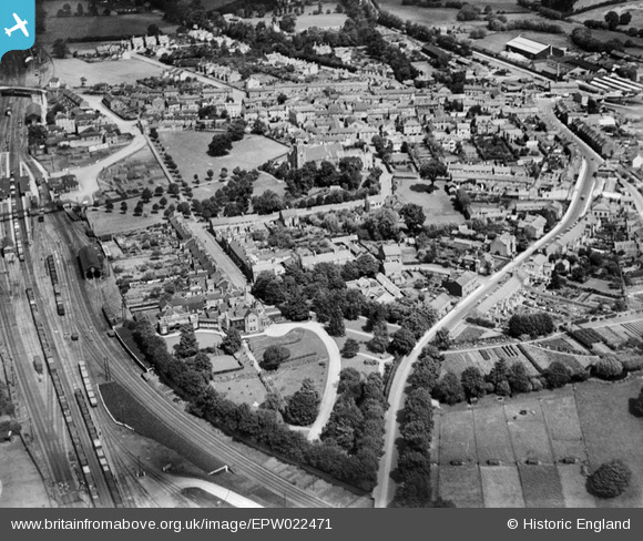
EPW022471 ENGLAND (1928). St Barnabas's Church and environs, Linslade, 1928
© Copyright OpenStreetMap contributors and licensed by the OpenStreetMap Foundation. 2025. Cartography is licensed as CC BY-SA.
Details
| Title | [EPW022471] St Barnabas's Church and environs, Linslade, 1928 |
| Reference | EPW022471 |
| Date | 9-August-1928 |
| Link | |
| Place name | LINSLADE |
| Parish | LEIGHTON-LINSLADE |
| District | |
| Country | ENGLAND |
| Easting / Northing | 491187, 224796 |
| Longitude / Latitude | -0.67411188301456, 51.913784435576 |
| National Grid Reference | SP912248 |
Pins
 Mrs K |
Saturday 15th of August 2020 09:46:24 AM | |
 rodent |
Tuesday 15th of December 2015 11:47:12 AM | |
 melgibbs |
Thursday 26th of December 2013 08:15:56 PM | |
 Vonderene |
Friday 23rd of August 2013 05:45:20 PM | |
 Gellandi |
Monday 24th of June 2013 08:13:14 PM | |
 roxeth |
Saturday 17th of November 2012 11:58:14 PM | |
 roxeth |
Saturday 17th of November 2012 11:57:37 PM | |
 Straberries |
Monday 16th of July 2012 04:51:45 PM | |
 Straberries |
Monday 16th of July 2012 04:50:34 PM | |
 Straberries |
Monday 16th of July 2012 04:49:29 PM | |
 Straberries |
Monday 16th of July 2012 04:14:11 PM | |
 JP1000 |
Sunday 1st of July 2012 03:51:26 PM | |
 JP1000 |
Sunday 1st of July 2012 03:49:58 PM |
User Comment Contributions
 Puffpuffbuff |
Tuesday 26th of June 2012 08:16:17 AM |


