
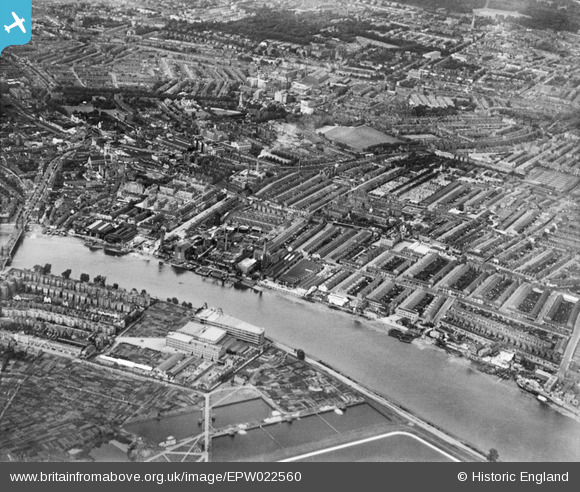
EPW022560 ENGLAND (1928). The Manbre Saccharine Works and environs, Fulham, from the south-west, 1928
© Copyright OpenStreetMap contributors and licensed by the OpenStreetMap Foundation. 2025. Cartography is licensed as CC BY-SA.
Nearby Images (17)
EPW022560

EPW022555

EPW022800

EPW010782

EPW024773

EPW024774

EPW024775

EPW022804

EPW022803

EPW022802

EPW022799

EPW059342

EPW022801

EPW022805

EPW022556

EPW022554

EPW022558

Details
| Title | [EPW022560] The Manbre Saccharine Works and environs, Fulham, from the south-west, 1928 |
| Reference | EPW022560 |
| Date | August-1928 |
| Link | |
| Place name | FULHAM |
| Parish | |
| District | |
| Country | ENGLAND |
| Easting / Northing | 523247, 177633 |
| Longitude / Latitude | -0.22483108443687, 51.483718281837 |
| National Grid Reference | TQ232776 |
Pins
 bondi |
Saturday 20th of December 2014 04:15:21 PM |