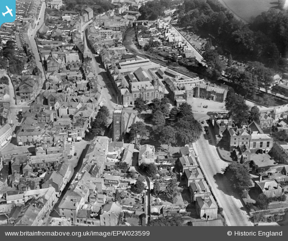
EPW023599 ENGLAND (1928). The church of St Eustachius and the town centre, Tavistock, 1928
© Copyright OpenStreetMap contributors and licensed by the OpenStreetMap Foundation. 2024. Cartography is licensed as CC BY-SA.
Nearby Images (7)
Details
| Title | [EPW023599] The church of St Eustachius and the town centre, Tavistock, 1928 |
| Reference | EPW023599 |
| Date | September-1928 |
| Link | |
| Place name | TAVISTOCK |
| Parish | TAVISTOCK |
| District | |
| Country | ENGLAND |
| Easting / Northing | 248163, 74426 |
| Longitude / Latitude | -4.1434607131315, 50.549261232446 |
| National Grid Reference | SX482744 |
Pins
 MB |
Sunday 11th of September 2016 09:34:13 PM | |
 MB |
Sunday 11th of September 2016 09:33:49 PM | |
 Class31 |
Wednesday 17th of September 2014 01:01:55 PM | |
 Class31 |
Wednesday 17th of September 2014 12:58:47 PM | |
 Class31 |
Monday 28th of April 2014 05:00:02 PM | |
 MB |
Tuesday 11th of September 2012 02:14:29 PM |


![[EPW023599] The church of St Eustachius and the town centre, Tavistock, 1928](http://britainfromabove.org.uk/sites/all/libraries/aerofilms-images/public/100x100/EPW/023/EPW023599.jpg)
![[EPW023605] Bedford Square and the town centre, Tavistock, 1928](http://britainfromabove.org.uk/sites/all/libraries/aerofilms-images/public/100x100/EPW/023/EPW023605.jpg)
![[EPW023604] Bedford Square and environs, Tavistock, 1928](http://britainfromabove.org.uk/sites/all/libraries/aerofilms-images/public/100x100/EPW/023/EPW023604.jpg)
![[EPW023596] The church of St Eustachius and the town centre, Tavistock, 1928](http://britainfromabove.org.uk/sites/all/libraries/aerofilms-images/public/100x100/EPW/023/EPW023596.jpg)
![[EPW023595] Railway viaduct and the town centre, Tavistock, 1928](http://britainfromabove.org.uk/sites/all/libraries/aerofilms-images/public/100x100/EPW/023/EPW023595.jpg)
![[EPW011304] Russell Street and environs, Tavistock, 1924. This image has been produced from a copy-negative.](http://britainfromabove.org.uk/sites/all/libraries/aerofilms-images/public/100x100/EPW/011/EPW011304.jpg)
![[EPW023602] The railway viaduct and environs, Tavistock, 1928](http://britainfromabove.org.uk/sites/all/libraries/aerofilms-images/public/100x100/EPW/023/EPW023602.jpg)