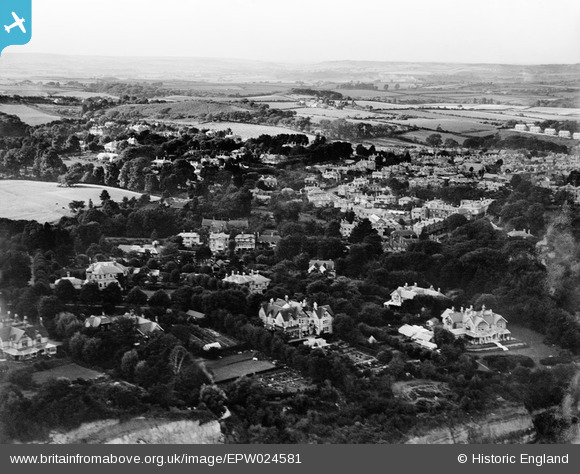
EPW024581 ENGLAND (1928). The town and surroundings, Shanklin, from the south-east, 1928
© Copyright OpenStreetMap contributors and licensed by the OpenStreetMap Foundation. 2025. Cartography is licensed as CC BY-SA.
Nearby Images (6)
Details
| Title | [EPW024581] The town and surroundings, Shanklin, from the south-east, 1928 |
| Reference | EPW024581 |
| Date | September-1928 |
| Link | |
| Place name | SHANKLIN |
| Parish | SHANKLIN |
| District | |
| Country | ENGLAND |
| Easting / Northing | 458360, 80750 |
| Longitude / Latitude | -1.1748850094983, 50.622945753402 |
| National Grid Reference | SZ584808 |
Pins
Be the first to add a comment to this image!


![[EPW024581] The town and surroundings, Shanklin, from the south-east, 1928](http://britainfromabove.org.uk/sites/all/libraries/aerofilms-images/public/100x100/EPW/024/EPW024581.jpg)
![[EPW024568] Big Meade Recreation Ground and environs, Shanklin, 1928](http://britainfromabove.org.uk/sites/all/libraries/aerofilms-images/public/100x100/EPW/024/EPW024568.jpg)
![[EPW024575] Big Meade Recreation Ground and surroundings, Shanklin, 1928](http://britainfromabove.org.uk/sites/all/libraries/aerofilms-images/public/100x100/EPW/024/EPW024575.jpg)
![[EPW024569] Big Meade Recreation Ground and environs, Shanklin, 1928](http://britainfromabove.org.uk/sites/all/libraries/aerofilms-images/public/100x100/EPW/024/EPW024569.jpg)
![[EPW022914] Beach huts at Appley Steps, Shanklin, 1928](http://britainfromabove.org.uk/sites/all/libraries/aerofilms-images/public/100x100/EPW/022/EPW022914.jpg)
![[EPW039649] Sandown Bay and the town, Shanklin, from the south-west, 1932](http://britainfromabove.org.uk/sites/all/libraries/aerofilms-images/public/100x100/EPW/039/EPW039649.jpg)