
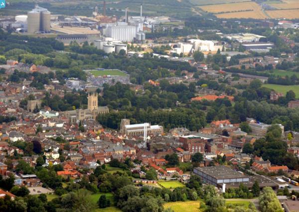
EPW025023 ENGLAND (1928). St James' Cathedral, St Mary's Church and the town, Bury St Edmunds, 1928

© Copyright OpenStreetMap contributors and licensed by the OpenStreetMap Foundation. 2025. Cartography is licensed as CC BY-SA.
Nearby Images (15)
EPW025023

EPW025020

EPW025021

EPW025022

EPW001752

EAW024398

EAW024395

EAW024397

EPW001750

EPW025024

EPW001773

EAW029745

EPW001753

EAW029742

EAW024396

Details
| Title | [EPW025023] St James' Cathedral, St Mary's Church and the town, Bury St Edmunds, 1928 |
| Reference | EPW025023 |
| Date | 9-October-1928 |
| Link | |
| Place name | BURY ST EDMUNDS |
| Parish | BURY ST. EDMUNDS |
| District | |
| Country | ENGLAND |
| Easting / Northing | 585535, 263989 |
| Longitude / Latitude | 0.71781548755005, 52.242368472762 |
| National Grid Reference | TL855640 |
Pins
 |
 MorrisDancer |
Tuesday 10th of March 2015 07:23:41 PM |
MorrisDancer |
Thursday 5th of September 2013 10:35:38 PM | |
MorrisDancer |
Thursday 5th of September 2013 10:33:17 PM | |
JayGee |
Saturday 24th of August 2013 11:40:05 PM | |
Debz |
Saturday 27th of October 2012 01:22:57 PM |