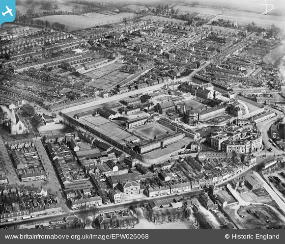
EPW026068 ENGLAND (1929). His Majesty's Prison, Maidstone, 1929
© Copyright OpenStreetMap contributors and licensed by the OpenStreetMap Foundation. 2025. Cartography is licensed as CC BY-SA.
Details
| Title | [EPW026068] His Majesty's Prison, Maidstone, 1929 |
| Reference | EPW026068 |
| Date | April-1929 |
| Link | |
| Place name | MAIDSTONE |
| Parish | |
| District | |
| Country | ENGLAND |
| Easting / Northing | 576090, 156406 |
| Longitude / Latitude | 0.52508388093333, 51.279034152826 |
| National Grid Reference | TQ761564 |
Pins
 Kentishman |
Thursday 10th of September 2015 07:35:20 AM | |
 Kentishman |
Thursday 10th of September 2015 07:19:40 AM | |
 Kentishman |
Thursday 10th of September 2015 07:17:55 AM | |
 John |
Tuesday 25th of August 2015 11:03:30 AM | |
 John |
Tuesday 25th of August 2015 11:01:41 AM | |
 John |
Tuesday 25th of August 2015 11:01:04 AM | |
 John |
Tuesday 25th of August 2015 11:00:29 AM |


![[EPW026068] His Majesty's Prison, Maidstone, 1929](http://britainfromabove.org.uk/sites/all/libraries/aerofilms-images/public/100x100/EPW/026/EPW026068.jpg)
![[EPW009212] The Prison, Maidstone, 1923](http://britainfromabove.org.uk/sites/all/libraries/aerofilms-images/public/100x100/EPW/009/EPW009212.jpg)
![[EPW026069] The Army Barracks and His Majesty's Prison, Maidstone, 1929](http://britainfromabove.org.uk/sites/all/libraries/aerofilms-images/public/100x100/EPW/026/EPW026069.jpg)