
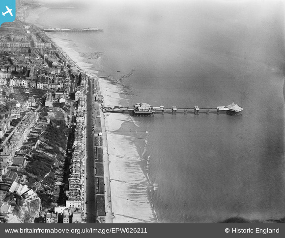
EPW026211 ENGLAND (1929). The Palace Pier and Hastings Pier and seafront, Hastings, from the west, 1929
© Copyright OpenStreetMap contributors and licensed by the OpenStreetMap Foundation. 2025. Cartography is licensed as CC BY-SA.
Nearby Images (9)
EPW026211

EAW002420

EPW000755

EAW002419

EAW002421

EPW000106
, Hastings, 1920")
EPW026194

EPW035335

EPW035337

Details
| Title | [EPW026211] The Palace Pier and Hastings Pier and seafront, Hastings, from the west, 1929 |
| Reference | EPW026211 |
| Date | 24-April-1929 |
| Link | |
| Place name | HASTINGS |
| Parish | |
| District | |
| Country | ENGLAND |
| Easting / Northing | 579548, 108701 |
| Longitude / Latitude | 0.5509370089576, 50.849364709405 |
| National Grid Reference | TQ795087 |
Pins
 S00Z |
Friday 20th of September 2013 10:29:21 AM | |
S00Z |
Friday 20th of September 2013 10:28:50 AM | |
The church was hit in 1944 by a damaged V1 'Doddlebug' flying bomb which had been hit out at sea and eventually crashed at the front of the church without a single casualty on the ground. The church was rebuilt between 1953 and 1961 by by Sir Giles Scott and A G Scott. See the church website at http://www.stleonardstethelburga.org.uk/welcome.htm |
John W |
Thursday 4th of May 2017 06:02:58 PM |
S00Z |
Friday 20th of September 2013 10:27:54 AM | |
S00Z |
Friday 20th of September 2013 09:47:56 AM |