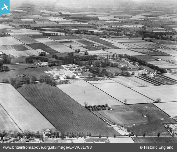
EPW031798 ENGLAND (1930). Hull Sanatorium and environs, Cottingham, 1930
© Copyright OpenStreetMap contributors and licensed by the OpenStreetMap Foundation. 2025. Cartography is licensed as CC BY-SA.
Nearby Images (2)
EPW031798

EPW031796

Details
| Title | [EPW031798] Hull Sanatorium and environs, Cottingham, 1930 |
| Reference | EPW031798 |
| Date | 30-April-1930 |
| Link | |
| Place name | COTTINGHAM |
| Parish | COTTINGHAM |
| District | |
| Country | ENGLAND |
| Easting / Northing | 502710, 432326 |
| Longitude / Latitude | -0.44120688206303, 53.776905563389 |
| National Grid Reference | TA027323 |
Pins
 dd1000 |
Wednesday 31st of July 2019 02:36:16 PM | |
dd1000 |
Wednesday 31st of July 2019 01:12:25 PM | |
dd1000 |
Tuesday 30th of July 2019 07:47:42 PM | |
 |
dd1000 |
Tuesday 30th of July 2019 01:46:00 PM |
 John Wass |
Saturday 29th of November 2014 03:05:36 PM |