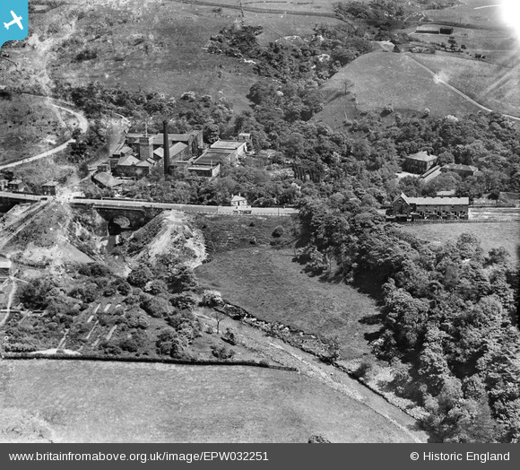
EPW032251 ENGLAND (1930). The Bardsley Vale Mills, Highfield Terrace and Bardsley Bridge, Limehurst, 1930. This image has been produced from a damaged negative.
© Copyright OpenStreetMap contributors and licensed by the OpenStreetMap Foundation. 2025. Cartography is licensed as CC BY-SA.
Nearby Images (10)
Details
| Title | [EPW032251] The Bardsley Vale Mills, Highfield Terrace and Bardsley Bridge, Limehurst, 1930. This image has been produced from a damaged negative. |
| Reference | EPW032251 |
| Date | June-1930 |
| Link | |
| Place name | LIMEHURST |
| Parish | |
| District | |
| Country | ENGLAND |
| Easting / Northing | 393019, 401237 |
| Longitude / Latitude | -2.1052713180625, 53.507525586095 |
| National Grid Reference | SD930012 |
Pins
 bassman |
Wednesday 24th of June 2015 08:20:00 PM | |
 John T. Pitman |
Wednesday 15th of October 2014 11:46:06 PM |


![[EPW032251] The Bardsley Vale Mills, Highfield Terrace and Bardsley Bridge, Limehurst, 1930. This image has been produced from a damaged negative.](http://britainfromabove.org.uk/sites/all/libraries/aerofilms-images/public/100x100/EPW/032/EPW032251.jpg)
![[EPW032248] The Bardsley Vale Mills and Bardsley Bridge, Limehurst, 1930. This image has been produced from a damaged negative.](http://britainfromabove.org.uk/sites/all/libraries/aerofilms-images/public/100x100/EPW/032/EPW032248.jpg)
![[EPW032258] The Bardsley Vale Mills, Oldham Road and the Bardsley Brewery, Limehurst, 1930. This image has been affected by flare.](http://britainfromabove.org.uk/sites/all/libraries/aerofilms-images/public/100x100/EPW/032/EPW032258.jpg)
![[EPW032256] The Bardsley Vale Mills, the Stafford Works and Oldham Road, Limehurst, 1930. This image has been produced from a damaged negative.](http://britainfromabove.org.uk/sites/all/libraries/aerofilms-images/public/100x100/EPW/032/EPW032256.jpg)
![[EPW032249] The Bardsley Vale Mills, the Bardsley Brewery and Bardsley Bridge, Limehurst, 1930. This image has been produced from a damaged negative.](http://britainfromabove.org.uk/sites/all/libraries/aerofilms-images/public/100x100/EPW/032/EPW032249.jpg)
![[EPW032247] The Bardsley Vale Mills and Bardsley Bridge, Limehurst, 1930](http://britainfromabove.org.uk/sites/all/libraries/aerofilms-images/public/100x100/EPW/032/EPW032247.jpg)
![[EPW032254] The Bardsley Vale Mills and Bardsley Bridge, Bardsley, 1930](http://britainfromabove.org.uk/sites/all/libraries/aerofilms-images/public/100x100/EPW/032/EPW032254.jpg)
![[EPW032253] The Bardsley Vale Mills, Bardsley Bridge and Valley Farm, Limehurst, 1930](http://britainfromabove.org.uk/sites/all/libraries/aerofilms-images/public/100x100/EPW/032/EPW032253.jpg)
![[EPW032257] The Bardsley Vale Mills and environs, Limehurst, 1930. This image has been produced from a damaged negative.](http://britainfromabove.org.uk/sites/all/libraries/aerofilms-images/public/100x100/EPW/032/EPW032257.jpg)
![[EPW032255] The Bardsley Vale Mills and environs, Limehurst, 1930. This image has been produced from a damaged negative.](http://britainfromabove.org.uk/sites/all/libraries/aerofilms-images/public/100x100/EPW/032/EPW032255.jpg)