
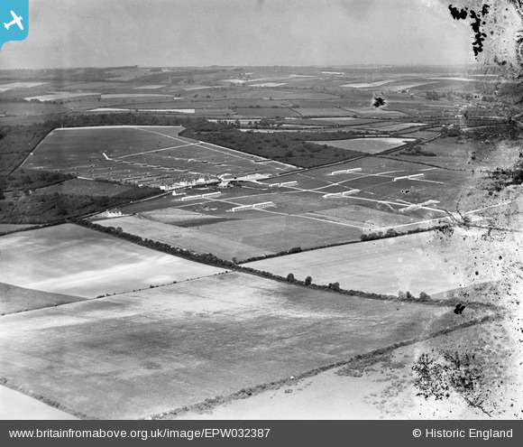
EPW032387 ENGLAND (1930). The Milborne Wood Poultry Farm and surrounding countryside, Milborne Wood, from the south-west, 1930. This image has been produced from a damaged negative.
© Copyright OpenStreetMap contributors and licensed by the OpenStreetMap Foundation. 2025. Cartography is licensed as CC BY-SA.
Nearby Images (2)
EPW032387

EPW032389

Details
| Title | [EPW032387] The Milborne Wood Poultry Farm and surrounding countryside, Milborne Wood, from the south-west, 1930. This image has been produced from a damaged negative. |
| Reference | EPW032387 |
| Date | June-1930 |
| Link | |
| Place name | MILBORNE WOOD |
| Parish | DEWLISH |
| District | |
| Country | ENGLAND |
| Easting / Northing | 378442, 96223 |
| Longitude / Latitude | -2.3057126607016, 50.764626881167 |
| National Grid Reference | SY784962 |
Pins
 Class31 |
Tuesday 19th of March 2013 06:42:21 PM |