
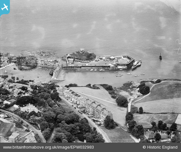
EPW032983 ENGLAND (1930). Lantern Hill, the harbour and environs, Ilfracombe, 1930
© Copyright OpenStreetMap contributors and licensed by the OpenStreetMap Foundation. 2025. Cartography is licensed as CC BY-SA.
Nearby Images (7)
EPW032983

EPW000959

EPW032988

EPW000971

EPW000960

EPW039946

EPW039947

Details
| Title | [EPW032983] Lantern Hill, the harbour and environs, Ilfracombe, 1930 |
| Reference | EPW032983 |
| Date | July-1930 |
| Link | |
| Place name | ILFRACOMBE |
| Parish | ILFRACOMBE |
| District | |
| Country | ENGLAND |
| Easting / Northing | 252530, 147826 |
| Longitude / Latitude | -4.1114742318167, 51.210057006477 |
| National Grid Reference | SS525478 |
Pins
Be the first to add a comment to this image!