
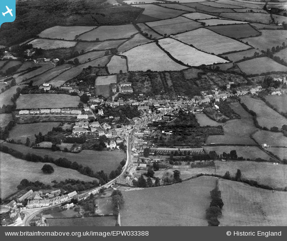
EPW033388 ENGLAND (1930). Bovey Bridge, the town and surrounding countryside, Bovey Tracey, 1930
© Copyright OpenStreetMap contributors and licensed by the OpenStreetMap Foundation. 2025. Cartography is licensed as CC BY-SA.
Nearby Images (3)
EPW033388

EPW033386

EPW033385

Details
| Title | [EPW033388] Bovey Bridge, the town and surrounding countryside, Bovey Tracey, 1930 |
| Reference | EPW033388 |
| Date | July-1930 |
| Link | |
| Place name | BOVEY TRACEY |
| Parish | BOVEY TRACEY |
| District | |
| Country | ENGLAND |
| Easting / Northing | 281624, 78549 |
| Longitude / Latitude | -3.6726534159107, 50.59406258342 |
| National Grid Reference | SX816785 |
Pins
 MB |
Saturday 9th of November 2013 08:49:43 PM | |
MB |
Saturday 9th of November 2013 08:45:46 PM | |
MB |
Saturday 9th of November 2013 08:45:17 PM | |
MB |
Saturday 9th of November 2013 08:44:48 PM | |
MB |
Saturday 9th of November 2013 08:44:11 PM |