
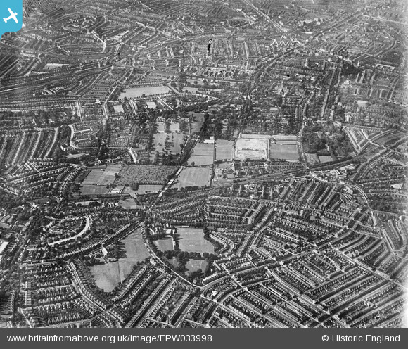
EPW033998 ENGLAND (1930). Green Dale and surroundings, East Dulwich, from the south-east, 1930
© Copyright OpenStreetMap contributors and licensed by the OpenStreetMap Foundation. 2025. Cartography is licensed as CC BY-SA.
Nearby Images (4)
EPW033998

EPW033996

EPW034000

EAW022352

Details
| Title | [EPW033998] Green Dale and surroundings, East Dulwich, from the south-east, 1930 |
| Reference | EPW033998 |
| Date | July-1930 |
| Link | |
| Place name | EAST DULWICH |
| Parish | |
| District | |
| Country | ENGLAND |
| Easting / Northing | 533473, 174679 |
| Longitude / Latitude | -0.078743987242324, 51.45484802838 |
| National Grid Reference | TQ335747 |
Pins
 johnbeardy |
Thursday 18th of June 2020 12:46:33 PM | |
Toplotdog |
Sunday 31st of May 2015 04:58:31 PM | |
Keith Blakeman |
Friday 23rd of January 2015 02:28:52 PM | |
John |
Thursday 9th of October 2014 06:13:53 PM |