
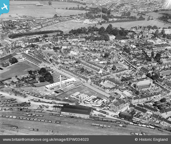
EPW034023 ENGLAND (1930). The town centre, Stafford, 1930
© Copyright OpenStreetMap contributors and licensed by the OpenStreetMap Foundation. 2025. Cartography is licensed as CC BY-SA.
Nearby Images (14)
EPW034023

EPW053858

EPW053862

EPW053861

EPW053863

EPW053859

EPW053857

EPW034020

EPW053860

EPW014105

EPW053378

EPW020051

EPW053374

EAW024956

Details
| Title | [EPW034023] The town centre, Stafford, 1930 |
| Reference | EPW034023 |
| Date | July-1930 |
| Link | |
| Place name | STAFFORD |
| Parish | |
| District | |
| Country | ENGLAND |
| Easting / Northing | 392296, 322693 |
| Longitude / Latitude | -2.1142833483888, 52.801407623491 |
| National Grid Reference | SJ923227 |
Pins
 staffordian |
Monday 14th of February 2022 01:38:02 PM | |
Dobbo |
Tuesday 24th of June 2014 09:02:15 PM | |
 bescotbeast |
Monday 16th of September 2013 04:19:11 PM | |
bescotbeast |
Monday 16th of September 2013 03:44:45 PM | |
bescotbeast |
Monday 16th of September 2013 03:44:26 PM |