
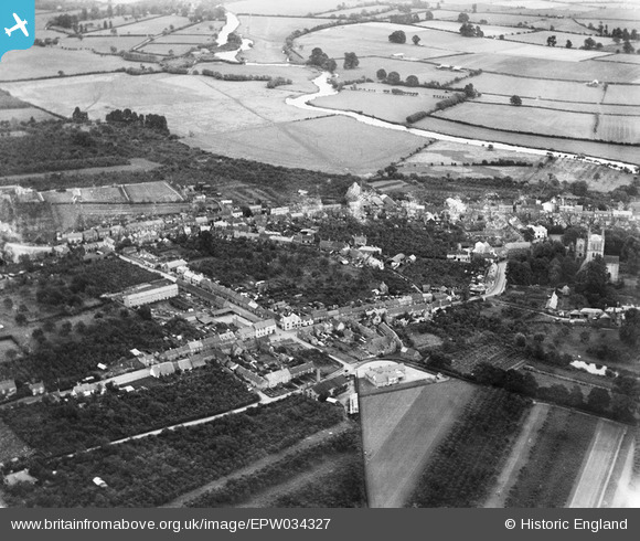
EPW034327 ENGLAND (1930). Head Street and environs, Pershore, from the south-west, 1930
© Copyright OpenStreetMap contributors and licensed by the OpenStreetMap Foundation. 2025. Cartography is licensed as CC BY-SA.
Nearby Images (3)
EPW034327

EPW034328

EPW023952

Details
| Title | [EPW034327] Head Street and environs, Pershore, from the south-west, 1930 |
| Reference | EPW034327 |
| Date | July-1930 |
| Link | |
| Place name | PERSHORE |
| Parish | PERSHORE |
| District | |
| Country | ENGLAND |
| Easting / Northing | 394512, 245874 |
| Longitude / Latitude | -2.080146728009, 52.110752376725 |
| National Grid Reference | SO945459 |
Pins
Be the first to add a comment to this image!