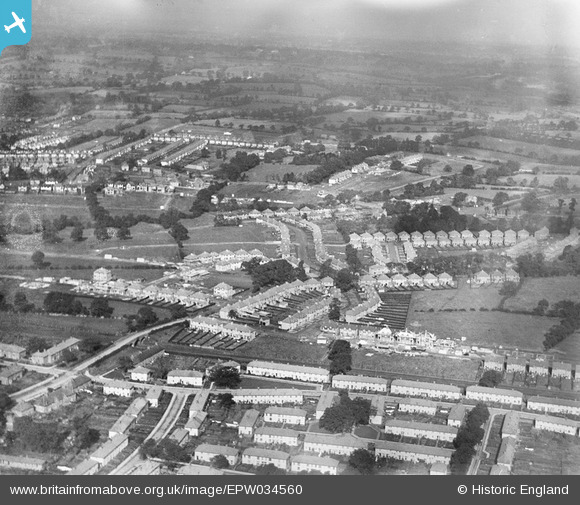
EPW034560 ENGLAND (1930). New housing at Deans Way and environs, Edgware, from the south-east, 1930
© Copyright OpenStreetMap contributors and licensed by the OpenStreetMap Foundation. 2025. Cartography is licensed as CC BY-SA.
Nearby Images (6)
Details
| Title | [EPW034560] New housing at Deans Way and environs, Edgware, from the south-east, 1930 |
| Reference | EPW034560 |
| Date | August-1930 |
| Link | |
| Place name | EDGWARE |
| Parish | |
| District | |
| Country | ENGLAND |
| Easting / Northing | 520307, 191738 |
| Longitude / Latitude | -0.26233150717231, 51.611131502556 |
| National Grid Reference | TQ203917 |
Pins
 Class31 |
Tuesday 30th of July 2013 11:11:56 PM | |
 Class31 |
Tuesday 30th of July 2013 11:11:20 PM | |
 Class31 |
Tuesday 30th of July 2013 11:10:24 PM | |
 Class31 |
Tuesday 30th of July 2013 11:08:12 PM | |
 Class31 |
Tuesday 30th of July 2013 11:07:36 PM | |
 Class31 |
Tuesday 30th of July 2013 11:07:00 PM |


![[EPW034560] New housing at Deans Way and environs, Edgware, from the south-east, 1930](http://britainfromabove.org.uk/sites/all/libraries/aerofilms-images/public/100x100/EPW/034/EPW034560.jpg)
![[EAW033377] Burnt Oak, Edgware and environs, Edgware, from the south-east, 1950. This image was marked by Aerofilms Ltd for photo editing.](http://britainfromabove.org.uk/sites/all/libraries/aerofilms-images/public/100x100/EAW/033/EAW033377.jpg)
![[EPW035546] The Northern Line heading east, Deansbrook Road and environs, Burnt Oak, 1931](http://britainfromabove.org.uk/sites/all/libraries/aerofilms-images/public/100x100/EPW/035/EPW035546.jpg)
![[EAW033376] Burnt Oak, Edgware and environs, Burnt Oak, from the south, 1950. This image was marked by Aerofilms Ltd for photo editing.](http://britainfromabove.org.uk/sites/all/libraries/aerofilms-images/public/100x100/EAW/033/EAW033376.jpg)
![[EPW034566] New housing at Oakwood Drive, Edgware, 1930](http://britainfromabove.org.uk/sites/all/libraries/aerofilms-images/public/100x100/EPW/034/EPW034566.jpg)
![[EPW034557] New housing at Orchard Crescent, Edgware, from the south-west, 1930](http://britainfromabove.org.uk/sites/all/libraries/aerofilms-images/public/100x100/EPW/034/EPW034557.jpg)