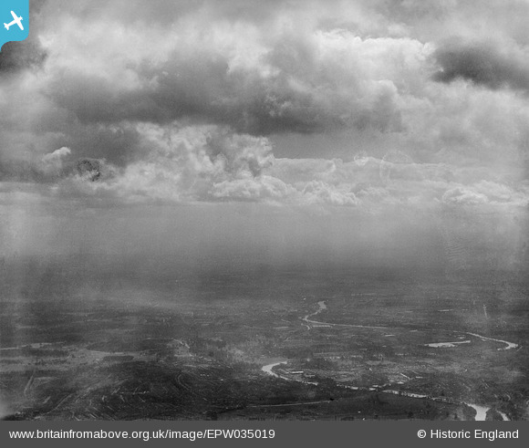
EPW035019 ENGLAND (1931). The River Thames and environs at St Margarets, Richmond, from the north-east, 1931
© Copyright OpenStreetMap contributors and licensed by the OpenStreetMap Foundation. 2024. Cartography is licensed as CC BY-SA.
Nearby Images (23)
Details
| Title | [EPW035019] The River Thames and environs at St Margarets, Richmond, from the north-east, 1931 |
| Reference | EPW035019 |
| Date | April-1931 |
| Link | |
| Place name | RICHMOND |
| Parish | |
| District | |
| Country | ENGLAND |
| Easting / Northing | 517920, 174131 |
| Longitude / Latitude | -0.30268933720029, 51.453376204002 |
| National Grid Reference | TQ179741 |
Pins
 Class31 |
Tuesday 24th of September 2013 07:59:42 PM |


![[EPW035019] The River Thames and environs at St Margarets, Richmond, from the north-east, 1931](http://britainfromabove.org.uk/sites/all/libraries/aerofilms-images/public/100x100/EPW/035/EPW035019.jpg)
![[EPW008870] The River Thames at Petersham Road, Richmond, 1923](http://britainfromabove.org.uk/sites/all/libraries/aerofilms-images/public/100x100/EPW/008/EPW008870.jpg)
![[EPW001699] Richmond and Richmond Bridge, Richmond, 1920](http://britainfromabove.org.uk/sites/all/libraries/aerofilms-images/public/100x100/EPW/001/EPW001699.jpg)
![[EPW022841] Bridges over the River Thames, Richmond, from the south-east, 1928](http://britainfromabove.org.uk/sites/all/libraries/aerofilms-images/public/100x100/EPW/022/EPW022841.jpg)
![[EPW036447] The British Legion Poppy Factory, Terrace Gardens and environs, Richmond, 1931](http://britainfromabove.org.uk/sites/all/libraries/aerofilms-images/public/100x100/EPW/036/EPW036447.jpg)
![[EPW001698] Richmond and Richmond Bridge, Richmond, 1920](http://britainfromabove.org.uk/sites/all/libraries/aerofilms-images/public/100x100/EPW/001/EPW001698.jpg)
![[EPW036449] The British Legion Poppy Factory, Terrace Gardens and the Sports Drome, Richmond, 1931](http://britainfromabove.org.uk/sites/all/libraries/aerofilms-images/public/100x100/EPW/036/EPW036449.jpg)
![[EPW036450] The British Legion Poppy Factory, the River Thames and Richmond Hill, Richmond, 1931](http://britainfromabove.org.uk/sites/all/libraries/aerofilms-images/public/100x100/EPW/036/EPW036450.jpg)
![[EPW036445] The British Legion Poppy Factory, the River Thames and Terrace Gardens, Richmond, 1931](http://britainfromabove.org.uk/sites/all/libraries/aerofilms-images/public/100x100/EPW/036/EPW036445.jpg)
![[EAW026800] The town centre, Richmond, from the south, 1949](http://britainfromabove.org.uk/sites/all/libraries/aerofilms-images/public/100x100/EAW/026/EAW026800.jpg)
![[EAW036493] The Metal Name Plate Works on Cambridge Road, Twickenham, 1951. This image has been produced from a print marked by Aerofilms Ltd for photo editing.](http://britainfromabove.org.uk/sites/all/libraries/aerofilms-images/public/100x100/EAW/036/EAW036493.jpg)
![[EAW036495] The Metal Name Plate Works on Cambridge Road, Twickenham, 1951. This image has been produced from a print marked by Aerofilms Ltd for photo editing.](http://britainfromabove.org.uk/sites/all/libraries/aerofilms-images/public/100x100/EAW/036/EAW036495.jpg)
![[EPW036448] The British Legion Poppy Factory, the River Thames and Terrace Gardens, Richmond, 1931](http://britainfromabove.org.uk/sites/all/libraries/aerofilms-images/public/100x100/EPW/036/EPW036448.jpg)
![[EAW036494] The Metal Name Plate Works on Cambridge Road, Twickenham, 1951. This image has been produced from a print marked by Aerofilms Ltd for photo editing.](http://britainfromabove.org.uk/sites/all/libraries/aerofilms-images/public/100x100/EAW/036/EAW036494.jpg)
![[EPW036446] The British Legion Poppy Factory, Terrace Gardens and environs, Richmond, 1931](http://britainfromabove.org.uk/sites/all/libraries/aerofilms-images/public/100x100/EPW/036/EPW036446.jpg)
![[EPW036443] The British Legion Poppy Factory, the River Thames and Richmond Hill, Richmond, 1931](http://britainfromabove.org.uk/sites/all/libraries/aerofilms-images/public/100x100/EPW/036/EPW036443.jpg)
![[EPW036444] The British Legion Poppy Factory, Richmond Hill and environs, Richmond, 1931](http://britainfromabove.org.uk/sites/all/libraries/aerofilms-images/public/100x100/EPW/036/EPW036444.jpg)
![[EAW036500] The Metal Name Plate Works on Cambridge Road, Twickenham, 1951. This image has been produced from a print marked by Aerofilms Ltd for photo editing.](http://britainfromabove.org.uk/sites/all/libraries/aerofilms-images/public/100x100/EAW/036/EAW036500.jpg)
![[EAW036497] The Metal Name Plate Works on Cambridge Road and environs, Twickenham, 1951. This image has been produced from a print marked by Aerofilms Ltd for photo editing.](http://britainfromabove.org.uk/sites/all/libraries/aerofilms-images/public/100x100/EAW/036/EAW036497.jpg)
![[EPR000468] Richmond Hill Court and environs, Richmond Hill, 1935](http://britainfromabove.org.uk/sites/all/libraries/aerofilms-images/public/100x100/EPR/000/EPR000468.jpg)
![[EAW006953] The house of Sir John Archer alongside Terrace Field, Richmond Hill, 1947](http://britainfromabove.org.uk/sites/all/libraries/aerofilms-images/public/100x100/EAW/006/EAW006953.jpg)
![[EAW006960] The house of Sir John Archer alongside Terrace Field, Richmond Hill, 1947](http://britainfromabove.org.uk/sites/all/libraries/aerofilms-images/public/100x100/EAW/006/EAW006960.jpg)
![[EAW006961] The house of Sir John Archer alongside Terrace Field, Richmond Hill, 1947](http://britainfromabove.org.uk/sites/all/libraries/aerofilms-images/public/100x100/EAW/006/EAW006961.jpg)