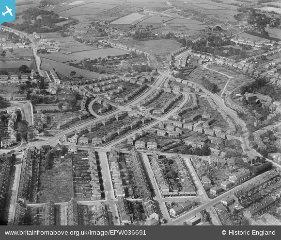
EPW036691 ENGLAND (1931). Housing at Hillsborough and Wadsley, Sheffield, 1931
© Copyright OpenStreetMap contributors and licensed by the OpenStreetMap Foundation. 2024. Cartography is licensed as CC BY-SA.
Nearby Images (9)
Details
| Title | [EPW036691] Housing at Hillsborough and Wadsley, Sheffield, 1931 |
| Reference | EPW036691 |
| Date | 14-September-1931 |
| Link | |
| Place name | SHEFFIELD |
| Parish | |
| District | |
| Country | ENGLAND |
| Easting / Northing | 432593, 390362 |
| Longitude / Latitude | -1.509644676615, 53.408804175652 |
| National Grid Reference | SK326904 |
Pins
 PabloS |
Friday 22nd of March 2024 09:49:40 AM | |
 PabloS |
Friday 22nd of March 2024 09:47:55 AM | |
 Gabes |
Friday 8th of May 2020 11:15:43 PM | |
 sum0 |
Wednesday 15th of April 2020 09:56:29 PM | |
 Annie G |
Monday 18th of November 2013 08:29:48 PM | |
 Annie G |
Monday 18th of November 2013 08:28:22 PM | |
 bayleaf |
Thursday 20th of June 2013 07:51:16 PM | |
 bayleaf |
Thursday 20th of June 2013 07:50:33 PM | |
 bayleaf |
Thursday 20th of June 2013 07:49:50 PM | |
 bayleaf |
Thursday 20th of June 2013 07:48:35 PM |


![[EPW036691] Housing at Hillsborough and Wadsley, Sheffield, 1931](http://britainfromabove.org.uk/sites/all/libraries/aerofilms-images/public/100x100/EPW/036/EPW036691.jpg)
![[EPW036692] Housing at Hillsborough, Sheffield, 1931](http://britainfromabove.org.uk/sites/all/libraries/aerofilms-images/public/100x100/EPW/036/EPW036692.jpg)
![[EPW036690] Housing at Hillsborough and Hallowmoor, Sheffield, 1931](http://britainfromabove.org.uk/sites/all/libraries/aerofilms-images/public/100x100/EPW/036/EPW036690.jpg)
![[EPW036694] Housing at Hillsborough and Wadsley, Sheffield, 1931](http://britainfromabove.org.uk/sites/all/libraries/aerofilms-images/public/100x100/EPW/036/EPW036694.jpg)
![[EPW036696] Housing at Hillsborough and Wadsley, Sheffield, 1931](http://britainfromabove.org.uk/sites/all/libraries/aerofilms-images/public/100x100/EPW/036/EPW036696.jpg)
![[EPW036688] Housing at Hillsborough and the Hillsborough Football Stadium in the distance, Sheffield, 1931](http://britainfromabove.org.uk/sites/all/libraries/aerofilms-images/public/100x100/EPW/036/EPW036688.jpg)
![[EPW036695] Housing at Hillsborough, Sheffield, 1931](http://britainfromabove.org.uk/sites/all/libraries/aerofilms-images/public/100x100/EPW/036/EPW036695.jpg)
![[EPW036693] Housing at Hillsborough, Sheffield, 1931](http://britainfromabove.org.uk/sites/all/libraries/aerofilms-images/public/100x100/EPW/036/EPW036693.jpg)
![[EPW036689] Housing at Hallowmoor, Hillsborough Football Stadium and Hillsborough Park in the distance, Sheffield, 1931](http://britainfromabove.org.uk/sites/all/libraries/aerofilms-images/public/100x100/EPW/036/EPW036689.jpg)