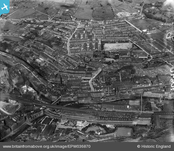
EPW036870 ENGLAND (1931). The town, Sowerby Bridge, 1931
© Copyright OpenStreetMap contributors and licensed by the OpenStreetMap Foundation. 2025. Cartography is licensed as CC BY-SA.
Details
| Title | [EPW036870] The town, Sowerby Bridge, 1931 |
| Reference | EPW036870 |
| Date | September-1931 |
| Link | |
| Place name | SOWERBY BRIDGE |
| Parish | |
| District | |
| Country | ENGLAND |
| Easting / Northing | 405945, 423721 |
| Longitude / Latitude | -1.9099221289076, 53.709653449364 |
| National Grid Reference | SE059237 |
Pins
 fido |
Saturday 28th of November 2020 05:59:15 PM | |
 fido |
Saturday 28th of November 2020 05:58:25 PM | |
 fido |
Saturday 28th of November 2020 05:55:25 PM | |
 John W |
Monday 31st of August 2020 09:39:19 PM | |
 John W |
Monday 31st of August 2020 09:32:51 PM | |
 John W |
Monday 31st of August 2020 09:28:48 PM | |
 RT |
Monday 19th of March 2018 12:27:35 PM | |
 RT |
Monday 19th of March 2018 12:23:19 PM | |
 RT |
Monday 12th of March 2018 03:11:15 PM | |
 Sooz |
Sunday 14th of June 2015 07:01:41 PM | |
 David Cant |
Tuesday 4th of November 2014 07:49:34 PM | |
 Toby Clempson |
Tuesday 12th of November 2013 07:31:14 AM | |
 Toby Clempson |
Tuesday 12th of November 2013 07:30:23 AM | |
 norland2 |
Tuesday 18th of December 2012 08:41:43 PM |


![[EPW036870] The town, Sowerby Bridge, 1931](http://britainfromabove.org.uk/sites/all/libraries/aerofilms-images/public/100x100/EPW/036/EPW036870.jpg)
![[EPW036871] Wharf Street and the town, Sowerby Bridge, 1931](http://britainfromabove.org.uk/sites/all/libraries/aerofilms-images/public/100x100/EPW/036/EPW036871.jpg)
![[EPW036872] The town, Sowerby Bridge, 1931](http://britainfromabove.org.uk/sites/all/libraries/aerofilms-images/public/100x100/EPW/036/EPW036872.jpg)