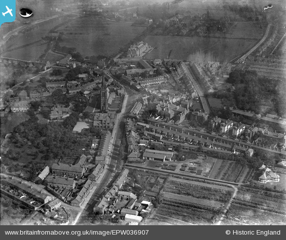
EPW036907 ENGLAND (1931). Overleigh Road and St Mary's Church, Handbridge, 1931
© Copyright OpenStreetMap contributors and licensed by the OpenStreetMap Foundation. 2025. Cartography is licensed as CC BY-SA.
Details
| Title | [EPW036907] Overleigh Road and St Mary's Church, Handbridge, 1931 |
| Reference | EPW036907 |
| Date | September-1931 |
| Link | |
| Place name | HANDBRIDGE |
| Parish | |
| District | |
| Country | ENGLAND |
| Easting / Northing | 340701, 365394 |
| Longitude / Latitude | -2.8874364415047, 53.182049222432 |
| National Grid Reference | SJ407654 |


![[EPW036907] Overleigh Road and St Mary's Church, Handbridge, 1931](http://britainfromabove.org.uk/sites/all/libraries/aerofilms-images/public/100x100/EPW/036/EPW036907.jpg)
![[EPW058006] St Mary's Church, The Castle and the town, Chester, 1938. This image has been produced from a damaged negative.](http://britainfromabove.org.uk/sites/all/libraries/aerofilms-images/public/100x100/EPW/058/EPW058006.jpg)
![[EPW029590] City High School, Chester, 1929. This image has been produced from a print.](http://britainfromabove.org.uk/sites/all/libraries/aerofilms-images/public/100x100/EPW/029/EPW029590.jpg)
