
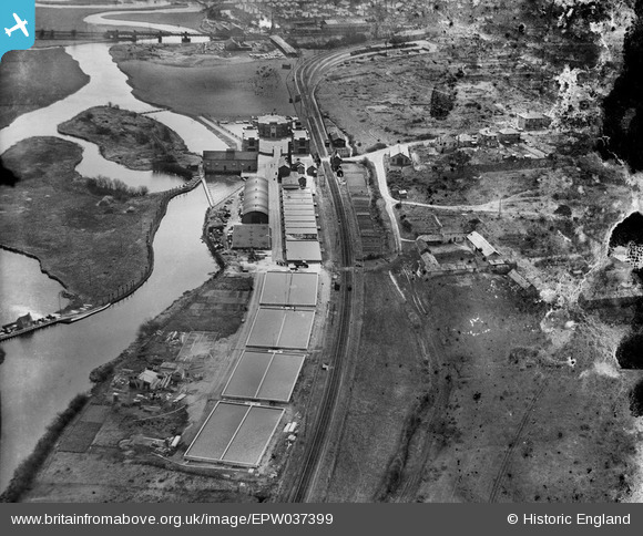
EPW037399 ENGLAND (1932). The West Hampshire Water Works, Christchurch, 1932. This image has been produced from a damaged negative.
© Copyright OpenStreetMap contributors and licensed by the OpenStreetMap Foundation. 2025. Cartography is licensed as CC BY-SA.
Nearby Images (3)
EPW037399

EPW037398

EPW037404

Details
| Title | [EPW037399] The West Hampshire Water Works, Christchurch, 1932. This image has been produced from a damaged negative. |
| Reference | EPW037399 |
| Date | April-1932 |
| Link | |
| Place name | CHRISTCHURCH |
| Parish | |
| District | |
| Country | ENGLAND |
| Easting / Northing | 415395, 93895 |
| Longitude / Latitude | -1.7817810220324, 50.743886129606 |
| National Grid Reference | SZ154939 |
Pins
 Peter Kazmierczak |
Wednesday 18th of September 2013 10:49:53 AM | |
Peter Kazmierczak |
Wednesday 18th of September 2013 10:49:18 AM | |
Peter Kazmierczak |
Wednesday 18th of September 2013 10:47:47 AM | |
 micky |
Thursday 7th of March 2013 12:04:16 PM | |
The last day of service was 28th September 1935 and the track was lifted in 1937. |
MikeMist |
Saturday 19th of April 2014 08:09:41 PM |