
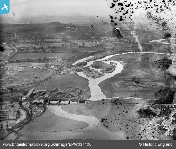
EPW037400 ENGLAND (1932). The West Hampshire Water Works, the River Avon and environs, Christchurch, from the south-east, 1932. This image has been produced from a damaged negative.
© Copyright OpenStreetMap contributors and licensed by the OpenStreetMap Foundation. 2025. Cartography is licensed as CC BY-SA.
Nearby Images (2)
EPW037400

EPW037404

Details
| Title | [EPW037400] The West Hampshire Water Works, the River Avon and environs, Christchurch, from the south-east, 1932. This image has been produced from a damaged negative. |
| Reference | EPW037400 |
| Date | April-1932 |
| Link | |
| Place name | CHRISTCHURCH |
| Parish | |
| District | |
| Country | ENGLAND |
| Easting / Northing | 415653, 93500 |
| Longitude / Latitude | -1.7781407744115, 50.740326754281 |
| National Grid Reference | SZ157935 |
Pins
 MikeMist |
Saturday 19th of April 2014 08:03:56 PM | |
MikeMist |
Saturday 19th of April 2014 07:55:00 PM | |
MikeMist |
Saturday 19th of April 2014 07:54:03 PM | |
MikeMist |
Saturday 19th of April 2014 07:51:48 PM | |
MikeMist |
Saturday 19th of April 2014 07:50:15 PM |