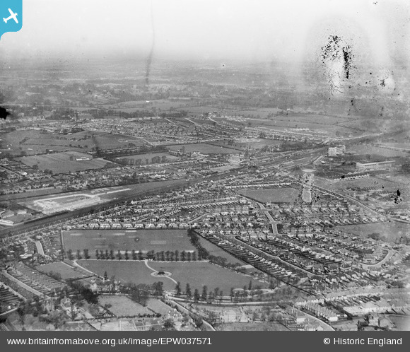
EPW037571 ENGLAND (1932). New housing estates around North Wembley Railway Station, North Wembley, from the south-east, 1932
© Copyright OpenStreetMap contributors and licensed by the OpenStreetMap Foundation. 2025. Cartography is licensed as CC BY-SA.
Details
| Title | [EPW037571] New housing estates around North Wembley Railway Station, North Wembley, from the south-east, 1932 |
| Reference | EPW037571 |
| Date | April-1932 |
| Link | |
| Place name | NORTH WEMBLEY |
| Parish | |
| District | |
| Country | ENGLAND |
| Easting / Northing | 518219, 185770 |
| Longitude / Latitude | -0.29448533346594, 51.55793122136 |
| National Grid Reference | TQ182858 |
Pins
 Graham |
Tuesday 14th of May 2013 10:54:09 PM | |
 Graham |
Tuesday 14th of May 2013 10:52:32 PM | |
 Graham |
Tuesday 14th of May 2013 10:51:28 PM | |
 Graham |
Tuesday 14th of May 2013 10:50:32 PM | |
 Graham |
Tuesday 14th of May 2013 10:49:02 PM | |
 Graham |
Tuesday 14th of May 2013 10:48:23 PM |


![[EPW037571] New housing estates around North Wembley Railway Station, North Wembley, from the south-east, 1932](http://britainfromabove.org.uk/sites/all/libraries/aerofilms-images/public/100x100/EPW/037/EPW037571.jpg)
![[EPW037568] New housing estates around North Wembley Railway Station, North Wembley, from the south-east, 1932](http://britainfromabove.org.uk/sites/all/libraries/aerofilms-images/public/100x100/EPW/037/EPW037568.jpg)
![[EPW037567] New housing estates around North Wembley Railway Station, North Wembley, from the south-east, 1932](http://britainfromabove.org.uk/sites/all/libraries/aerofilms-images/public/100x100/EPW/037/EPW037567.jpg)