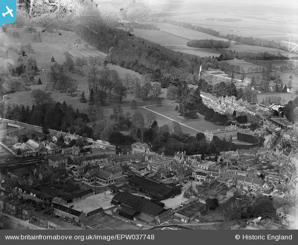
EPW037748 ENGLAND (1932). Cirencester Park and the town, Cirencester, 1932
© Copyright OpenStreetMap contributors and licensed by the OpenStreetMap Foundation. 2025. Cartography is licensed as CC BY-SA.
Nearby Images (8)
Details
| Title | [EPW037748] Cirencester Park and the town, Cirencester, 1932 |
| Reference | EPW037748 |
| Date | May-1932 |
| Link | |
| Place name | CIRENCESTER |
| Parish | CIRENCESTER |
| District | |
| Country | ENGLAND |
| Easting / Northing | 401868, 201984 |
| Longitude / Latitude | -1.9729578315573, 51.716123197191 |
| National Grid Reference | SP019020 |
Pins
 Helene Barrott |
Friday 3rd of January 2014 11:11:00 PM | |
Robert Tims |
Friday 13th of September 2013 02:40:54 PM | |
 GLOMR7 |
Thursday 27th of December 2012 11:41:56 PM |


![[EPW037748] Cirencester Park and the town, Cirencester, 1932](http://britainfromabove.org.uk/sites/all/libraries/aerofilms-images/public/100x100/EPW/037/EPW037748.jpg)
![[EPW037747] Cirencester Park and the town, Cirencester, 1932. This image has been produced from a damaged negative.](http://britainfromabove.org.uk/sites/all/libraries/aerofilms-images/public/100x100/EPW/037/EPW037747.jpg)
![[EAW015790] Cirencester Park, Cirencester, from the west, 1948. This image has been produced from a print.](http://britainfromabove.org.uk/sites/all/libraries/aerofilms-images/public/100x100/EAW/015/EAW015790.jpg)
![[EAW015788] The 188th US Army General Hospital in Cirencester Park, Cirencester, from the east, 1948. This image has been produced from a print marked by Aerofilms Ltd for photo editing.](http://britainfromabove.org.uk/sites/all/libraries/aerofilms-images/public/100x100/EAW/015/EAW015788.jpg)
![[EAW015789] Cirencester Park, Cirencester, 1948. This image has been produced from a print.](http://britainfromabove.org.uk/sites/all/libraries/aerofilms-images/public/100x100/EAW/015/EAW015789.jpg)
![[EAW031679] Cirencester Park and the Broad Ride, Cirencester, 1950](http://britainfromabove.org.uk/sites/all/libraries/aerofilms-images/public/100x100/EAW/031/EAW031679.jpg)
![[EAW015787] The 188th US Army General Hospital in Cirencester Park, Cirencester, 1948. This image has been produced from a print marked by Aerofilms Ltd for photo editing.](http://britainfromabove.org.uk/sites/all/libraries/aerofilms-images/public/100x100/EAW/015/EAW015787.jpg)
![[EAW031680] Cirencester Park, St John the Baptist's Church and the town centre, Cirencester, 1950](http://britainfromabove.org.uk/sites/all/libraries/aerofilms-images/public/100x100/EAW/031/EAW031680.jpg)