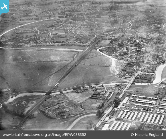
EPW038352 ENGLAND (1932). Mean Ham and environs, Gloucester, 1932
© Copyright OpenStreetMap contributors and licensed by the OpenStreetMap Foundation. 2025. Cartography is licensed as CC BY-SA.
Nearby Images (2)
EPW038352

EAW004057

Details
| Title | [EPW038352] Mean Ham and environs, Gloucester, 1932 |
| Reference | EPW038352 |
| Date | June-1932 |
| Link | |
| Place name | GLOUCESTER |
| Parish | |
| District | |
| Country | ENGLAND |
| Easting / Northing | 382696, 219186 |
| Longitude / Latitude | -2.2513591449412, 51.870539191752 |
| National Grid Reference | SO827192 |
Pins
 Ray Shill |
Thursday 7th of October 2021 12:24:47 PM | |
Toby Clempson |
Sunday 14th of October 2018 07:40:21 AM | |
Toby Clempson |
Sunday 14th of October 2018 07:37:39 AM | |
 Class31 |
Tuesday 9th of June 2015 01:26:45 PM | |
Class31 |
Friday 5th of June 2015 09:56:24 AM | |
 |
Class31 |
Friday 5th of June 2015 09:55:23 AM |
Class31 |
Friday 5th of June 2015 09:47:38 AM | |
 |
Class31 |
Friday 5th of June 2015 09:45:35 AM |
 |
Class31 |
Friday 5th of June 2015 09:39:12 AM |