
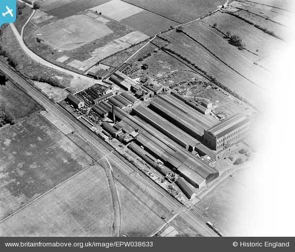
EPW038633 ENGLAND (1932). Lowfield Foundry, Balderton, 1932
© Copyright OpenStreetMap contributors and licensed by the OpenStreetMap Foundation. 2025. Cartography is licensed as CC BY-SA.
Nearby Images (8)
EPW038633

EPW038635

EPW038636

EPW038637

EPW038638

EPW038641

EPW038642

EPW038639

Details
| Title | [EPW038633] Lowfield Foundry, Balderton, 1932 |
| Reference | EPW038633 |
| Date | June-1932 |
| Link | |
| Place name | BALDERTON |
| Parish | BALDERTON |
| District | |
| Country | ENGLAND |
| Easting / Northing | 480644, 351190 |
| Longitude / Latitude | -0.7967632541247, 53.051575665988 |
| National Grid Reference | SK806512 |
Pins
Be the first to add a comment to this image!