
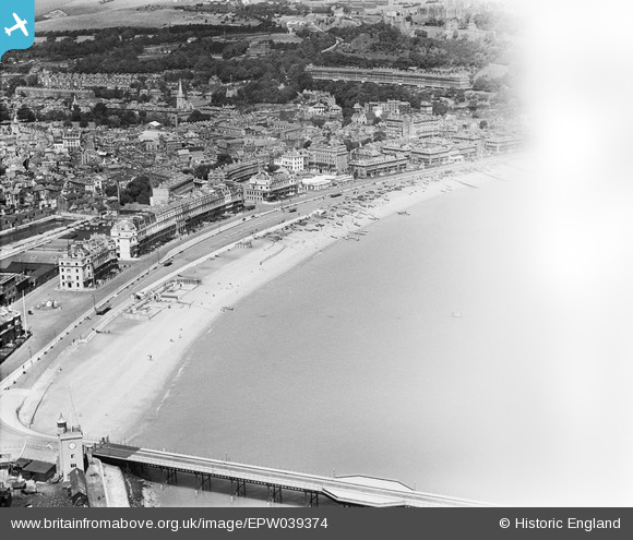
EPW039374 ENGLAND (1932). The town centre and the seafront, Dover, 1932. This image has been affected by flare.
© Copyright OpenStreetMap contributors and licensed by the OpenStreetMap Foundation. 2025. Cartography is licensed as CC BY-SA.
Nearby Images (16)
EPW039374

EPW039376

EAW007606

EPW035420

EPW000579

EPW019057

EAW007613

EAW007610

EAW007618

EAW030082

EPW039375

EAW007612

EAW020180

EPW000371

EAW020184

EAW020174

Details
| Title | [EPW039374] The town centre and the seafront, Dover, 1932. This image has been affected by flare. |
| Reference | EPW039374 |
| Date | August-1932 |
| Link | |
| Place name | DOVER |
| Parish | DOVER |
| District | |
| Country | ENGLAND |
| Easting / Northing | 632128, 141048 |
| Longitude / Latitude | 1.3174496889583, 51.121083003329 |
| National Grid Reference | TR321410 |
Pins
 Stu Giles |
Monday 21st of May 2018 11:48:02 PM |