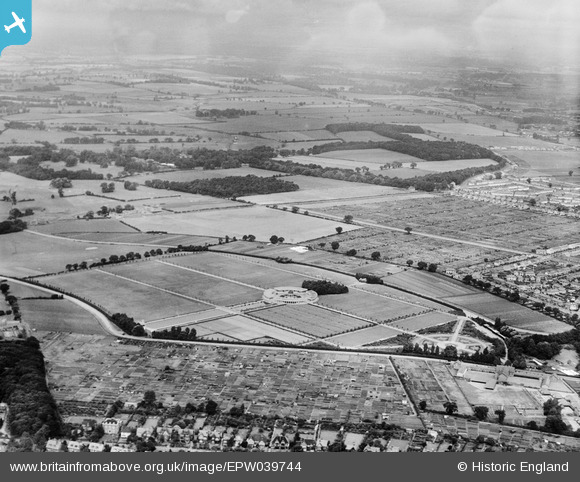
EPW039744 ENGLAND (1932). Eaton Park and surrounding countryside, Norwich, from the south-east, 1932
© Copyright OpenStreetMap contributors and licensed by the OpenStreetMap Foundation. 2025. Cartography is licensed as CC BY-SA.
Nearby Images (7)
Details
| Title | [EPW039744] Eaton Park and surrounding countryside, Norwich, from the south-east, 1932 |
| Reference | EPW039744 |
| Date | 23-July-1932 |
| Link | |
| Place name | NORWICH |
| Parish | |
| District | |
| Country | ENGLAND |
| Easting / Northing | 620711, 307408 |
| Longitude / Latitude | 1.2609370973063, 52.619148568576 |
| National Grid Reference | TG207074 |
Pins
 B.Young |
Thursday 17th of September 2015 09:36:11 AM | |
 B.Young |
Thursday 17th of September 2015 09:34:59 AM | |
 Class31 |
Saturday 20th of September 2014 07:51:57 PM | |
 Class31 |
Thursday 20th of June 2013 02:14:09 PM |
User Comment Contributions
 Eaton Park, Norwich, 02/09/2012 |
 Class31 |
Sunday 21st of September 2014 08:40:26 PM |


![[EPW039744] Eaton Park and surrounding countryside, Norwich, from the south-east, 1932](http://britainfromabove.org.uk/sites/all/libraries/aerofilms-images/public/100x100/EPW/039/EPW039744.jpg)
![[EPW021316] Eaton Park and environs, Norwich, 1928](http://britainfromabove.org.uk/sites/all/libraries/aerofilms-images/public/100x100/EPW/021/EPW021316.jpg)
![[EPW021313] Eaton Park, Norwich, 1928](http://britainfromabove.org.uk/sites/all/libraries/aerofilms-images/public/100x100/EPW/021/EPW021313.jpg)
![[EPW021221] Eaton Park, Eaton, 1928](http://britainfromabove.org.uk/sites/all/libraries/aerofilms-images/public/100x100/EPW/021/EPW021221.jpg)
![[EPW021314] Eaton Park and environs, Norwich, 1928](http://britainfromabove.org.uk/sites/all/libraries/aerofilms-images/public/100x100/EPW/021/EPW021314.jpg)
![[EPW021315] Eaton Park and environs, Norwich, 1928](http://britainfromabove.org.uk/sites/all/libraries/aerofilms-images/public/100x100/EPW/021/EPW021315.jpg)
![[EPW021312] Eaton Park and environs, Norwich, from the south-east, 1928](http://britainfromabove.org.uk/sites/all/libraries/aerofilms-images/public/100x100/EPW/021/EPW021312.jpg)

