
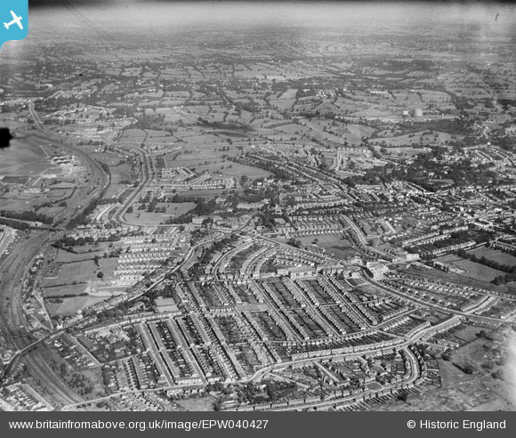
EPW040427 ENGLAND (1932). Housing development around Hendon Central, Hendon, from the south, 1932
© Copyright OpenStreetMap contributors and licensed by the OpenStreetMap Foundation. 2025. Cartography is licensed as CC BY-SA.
Nearby Images (12)
EPW040427

EPW040431

EPW031655

EPW040429

EPW040426

EPW040428

EPW016522

EPW040430

EPR000516

EPW016520

EPW038717

EPW009348

Details
| Title | [EPW040427] Housing development around Hendon Central, Hendon, from the south, 1932 |
| Reference | EPW040427 |
| Date | September-1932 |
| Link | |
| Place name | HENDON |
| Parish | |
| District | |
| Country | ENGLAND |
| Easting / Northing | 522682, 188333 |
| Longitude / Latitude | -0.22923626468244, 51.580014549804 |
| National Grid Reference | TQ227883 |
Pins
Be the first to add a comment to this image!