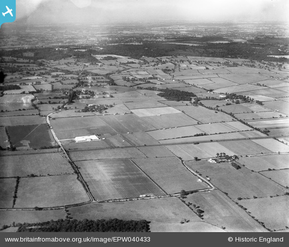
EPW040433 ENGLAND (1932). Alma Food Products Ltd and surrounding countryside, Great Warley, from the south, 1932
© Copyright OpenStreetMap contributors and licensed by the OpenStreetMap Foundation. 2024. Cartography is licensed as CC BY-SA.
Nearby Images (7)
Details
| Title | [EPW040433] Alma Food Products Ltd and surrounding countryside, Great Warley, from the south, 1932 |
| Reference | EPW040433 |
| Date | September-1932 |
| Link | |
| Place name | GREAT WARLEY |
| Parish | |
| District | |
| Country | ENGLAND |
| Easting / Northing | 559868, 187713 |
| Longitude / Latitude | 0.3068018664594, 51.565123196004 |
| National Grid Reference | TQ599877 |
Pins
Be the first to add a comment to this image!


![[EPW040433] Alma Food Products Ltd and surrounding countryside, Great Warley, from the south, 1932](http://britainfromabove.org.uk/sites/all/libraries/aerofilms-images/public/100x100/EPW/040/EPW040433.jpg)
![[EPW040434] Alma Food Products Ltd and surrounding countryside, Great Warley, from the south, 1932](http://britainfromabove.org.uk/sites/all/libraries/aerofilms-images/public/100x100/EPW/040/EPW040434.jpg)
![[EPW040436] Alma Food Products Ltd and surrounding countryside, Great Warley, from the south-west, 1932](http://britainfromabove.org.uk/sites/all/libraries/aerofilms-images/public/100x100/EPW/040/EPW040436.jpg)
![[EPW040435] Alma Food Products Ltd and surrounding countryside, Great Warley, from the south, 1932](http://britainfromabove.org.uk/sites/all/libraries/aerofilms-images/public/100x100/EPW/040/EPW040435.jpg)
![[EPW040437] Alma Food Products Ltd, Great Warley, from the south-east, 1932. This image has been produced from a damaged negative.](http://britainfromabove.org.uk/sites/all/libraries/aerofilms-images/public/100x100/EPW/040/EPW040437.jpg)
![[EPW040440] Alma Food Products Ltd, Great Warley, 1932](http://britainfromabove.org.uk/sites/all/libraries/aerofilms-images/public/100x100/EPW/040/EPW040440.jpg)
![[EPW040438] Alma Food Products Ltd, Great Warley, 1932](http://britainfromabove.org.uk/sites/all/libraries/aerofilms-images/public/100x100/EPW/040/EPW040438.jpg)