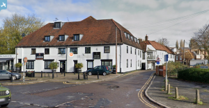
EPW041116 ENGLAND (1933). The High Street and environs, Uxbridge, 1933
© Copyright OpenStreetMap contributors and licensed by the OpenStreetMap Foundation. 2025. Cartography is licensed as CC BY-SA.
Nearby Images (17)
Details
| Title | [EPW041116] The High Street and environs, Uxbridge, 1933 |
| Reference | EPW041116 |
| Date | May-1933 |
| Link | |
| Place name | UXBRIDGE |
| Parish | |
| District | |
| Country | ENGLAND |
| Easting / Northing | 505512, 184159 |
| Longitude / Latitude | -0.47821549091984, 51.545970205246 |
| National Grid Reference | TQ055842 |
Pins
 Mark |
Saturday 19th of August 2023 10:18:41 PM | |
 Mark |
Saturday 19th of August 2023 10:13:19 PM | |
 jkm |
Friday 21st of May 2021 11:15:10 PM | |
 jkm |
Friday 21st of May 2021 11:13:24 PM | |
 jkm |
Friday 21st of May 2021 11:12:29 PM | |
 jkm |
Friday 21st of May 2021 11:11:37 PM | |
 The Laird |
Sunday 31st of May 2015 01:34:27 PM | |
 John Wass |
Tuesday 30th of December 2014 03:07:11 PM | |
 brian |
Friday 24th of January 2014 01:41:36 PM | |
 brian |
Friday 24th of January 2014 01:39:43 PM | |
 brian |
Friday 24th of January 2014 01:32:17 PM | |
 brian |
Friday 24th of January 2014 01:28:35 PM | |
 maryjane65 |
Saturday 8th of June 2013 05:56:28 PM | |
 maryjane65 |
Saturday 8th of June 2013 05:55:26 PM | |
 maryjane65 |
Saturday 8th of June 2013 05:52:09 PM | |
 maryjane65 |
Saturday 8th of June 2013 05:50:42 PM | |
 maryjane65 |
Saturday 8th of June 2013 05:43:26 PM | |
 maryjane65 |
Saturday 8th of June 2013 05:43:02 PM | |
 maryjane65 |
Saturday 8th of June 2013 05:42:09 PM | |
 maryjane65 |
Saturday 8th of June 2013 05:40:53 PM |


![[EPW041116] The High Street and environs, Uxbridge, 1933](http://britainfromabove.org.uk/sites/all/libraries/aerofilms-images/public/100x100/EPW/041/EPW041116.jpg)
![[EPW031256] The High Street and environs, Uxbridge, 1930](http://britainfromabove.org.uk/sites/all/libraries/aerofilms-images/public/100x100/EPW/031/EPW031256.jpg)
![[EPW041117] The High Street and environs, Uxbridge, 1933](http://britainfromabove.org.uk/sites/all/libraries/aerofilms-images/public/100x100/EPW/041/EPW041117.jpg)
![[EPW031258] The High Street and environs, Uxbridge, 1930](http://britainfromabove.org.uk/sites/all/libraries/aerofilms-images/public/100x100/EPW/031/EPW031258.jpg)
![[EPW031257] St Margaret's Church and the town centre, Uxbridge, 1930](http://britainfromabove.org.uk/sites/all/libraries/aerofilms-images/public/100x100/EPW/031/EPW031257.jpg)
![[EPW041118] Vine Street Station and the town, Uxbridge, 1933](http://britainfromabove.org.uk/sites/all/libraries/aerofilms-images/public/100x100/EPW/041/EPW041118.jpg)
![[EPW022776] High Street, Uxbridge, 1928. This image has been produced from a print.](http://britainfromabove.org.uk/sites/all/libraries/aerofilms-images/public/100x100/EPW/022/EPW022776.jpg)
![[EPW022771] The junction of Harefield Road and the High Street, Uxbridge, 1928. This image has been produced from a print.](http://britainfromabove.org.uk/sites/all/libraries/aerofilms-images/public/100x100/EPW/022/EPW022771.jpg)
![[EPW025808] The Metropolitan Depot, Uxbridge, 1929](http://britainfromabove.org.uk/sites/all/libraries/aerofilms-images/public/100x100/EPW/025/EPW025808.jpg)
![[EPW025814] The Metropolitan Depot, Uxbridge, 1929](http://britainfromabove.org.uk/sites/all/libraries/aerofilms-images/public/100x100/EPW/025/EPW025814.jpg)
![[EPW025813] The Metropolitan Depot, Uxbridge, 1929](http://britainfromabove.org.uk/sites/all/libraries/aerofilms-images/public/100x100/EPW/025/EPW025813.jpg)
![[EPW025815] The Metropolitan Depot, Uxbridge, 1929](http://britainfromabove.org.uk/sites/all/libraries/aerofilms-images/public/100x100/EPW/025/EPW025815.jpg)
![[EPW025812] The Metropolitan Depot, Uxbridge, 1929](http://britainfromabove.org.uk/sites/all/libraries/aerofilms-images/public/100x100/EPW/025/EPW025812.jpg)
![[EPW025807] The Metropolitan Depot, Uxbridge, 1929](http://britainfromabove.org.uk/sites/all/libraries/aerofilms-images/public/100x100/EPW/025/EPW025807.jpg)
![[EPW025810] The Metropolitan Depot, Uxbridge, 1929](http://britainfromabove.org.uk/sites/all/libraries/aerofilms-images/public/100x100/EPW/025/EPW025810.jpg)
![[EPW025806] The Metropolitan Depot, Uxbridge, 1929](http://britainfromabove.org.uk/sites/all/libraries/aerofilms-images/public/100x100/EPW/025/EPW025806.jpg)
![[EPW025811] The Metropolitan Depot, Uxbridge, 1929](http://britainfromabove.org.uk/sites/all/libraries/aerofilms-images/public/100x100/EPW/025/EPW025811.jpg)
