
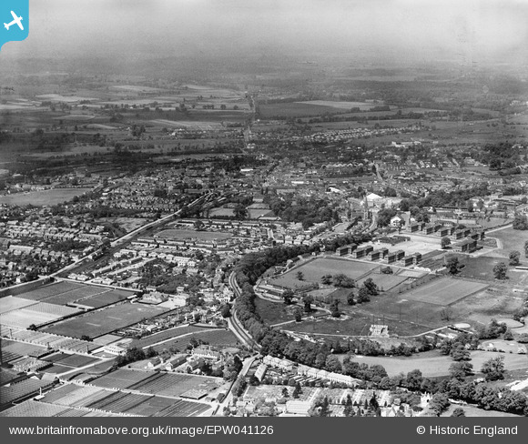
EPW041126 ENGLAND (1933). The Kingston Lane Nursery, Hillingdon Golf Course and the town, Uxbridge, from the south-east, 1933
© Copyright OpenStreetMap contributors and licensed by the OpenStreetMap Foundation. 2025. Cartography is licensed as CC BY-SA.
Nearby Images (3)
EPW041126

EPW041125

EPW041127

Details
| Title | [EPW041126] The Kingston Lane Nursery, Hillingdon Golf Course and the town, Uxbridge, from the south-east, 1933 |
| Reference | EPW041126 |
| Date | May-1933 |
| Link | |
| Place name | UXBRIDGE |
| Parish | |
| District | |
| Country | ENGLAND |
| Easting / Northing | 506178, 183164 |
| Longitude / Latitude | -0.46891379708692, 51.536900976996 |
| National Grid Reference | TQ062832 |
Pins
 DavidB |
Friday 2nd of September 2022 12:33:48 PM | |
banniere |
Monday 16th of February 2015 11:51:47 PM | |
brian |
Friday 24th of January 2014 02:38:15 PM | |
brian |
Friday 24th of January 2014 02:16:11 PM | |
brian |
Friday 24th of January 2014 02:12:32 PM | |
brian |
Friday 24th of January 2014 02:10:24 PM | |
brian |
Wednesday 1st of January 2014 10:14:50 PM | |
brian |
Wednesday 1st of January 2014 10:13:21 PM | |
maryjane65 |
Saturday 8th of June 2013 06:08:08 PM | |
i think this is Whitehall road, Cowley Road is to the south |
dave43 |
Thursday 17th of October 2013 08:05:28 PM |
maryjane65 |
Saturday 8th of June 2013 06:03:42 PM | |
maryjane65 |
Saturday 8th of June 2013 06:02:16 PM | |
maryjane65 |
Saturday 8th of June 2013 06:01:22 PM | |
dave43 |
Friday 17th of May 2013 09:58:16 PM |