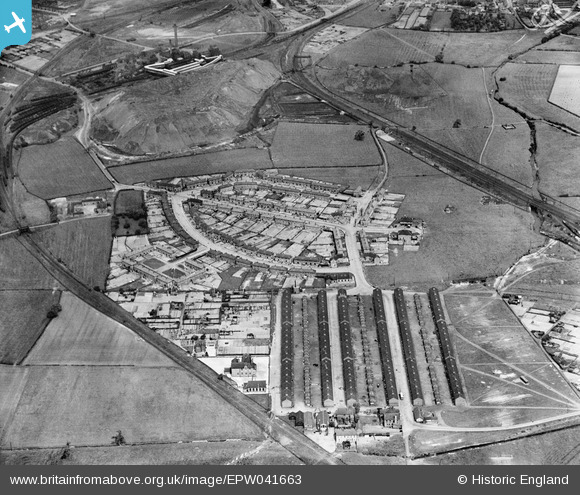
EPW041663 ENGLAND (1933). The village and the Ireland Colliery in the background, Poolsbrook, 1933
© Copyright OpenStreetMap contributors and licensed by the OpenStreetMap Foundation. 2025. Cartography is licensed as CC BY-SA.
Details
| Title | [EPW041663] The village and the Ireland Colliery in the background, Poolsbrook, 1933 |
| Reference | EPW041663 |
| Date | June-1933 |
| Link | |
| Place name | POOLSBROOK |
| Parish | STAVELEY |
| District | |
| Country | ENGLAND |
| Easting / Northing | 444178, 373668 |
| Longitude / Latitude | -1.3376904406517, 53.257897172328 |
| National Grid Reference | SK442737 |
Pins
 Waldemar |
Monday 14th of November 2022 08:41:22 PM | |
 Waldemar |
Monday 14th of November 2022 07:43:20 PM | |
 Waldemar |
Monday 14th of November 2022 07:42:30 PM | |
 Waldemar |
Monday 14th of November 2022 07:41:55 PM | |
 Waldemar |
Monday 14th of November 2022 07:37:37 PM | |
 Waldemar |
Monday 14th of November 2022 07:37:28 PM | |
 Waldemar |
Monday 14th of November 2022 07:37:07 PM | |
 Waldemar |
Monday 14th of November 2022 07:35:59 PM |


![[EPW041663] The village and the Ireland Colliery in the background, Poolsbrook, 1933](http://britainfromabove.org.uk/sites/all/libraries/aerofilms-images/public/100x100/EPW/041/EPW041663.jpg)
![[EPW041664] The village, Poolsbrook, 1933](http://britainfromabove.org.uk/sites/all/libraries/aerofilms-images/public/100x100/EPW/041/EPW041664.jpg)