
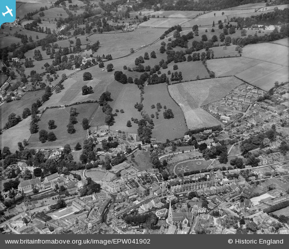
EPW041902 ENGLAND (1933). Badbrook and environs, Stroud, from the south, 1933
© Copyright OpenStreetMap contributors and licensed by the OpenStreetMap Foundation. 2025. Cartography is licensed as CC BY-SA.
Nearby Images (5)
EPW041902

EPW041878

EPW041903

EPW041876

EPW041877

Details
| Title | [EPW041902] Badbrook and environs, Stroud, from the south, 1933 |
| Reference | EPW041902 |
| Date | June-1933 |
| Link | |
| Place name | STROUD |
| Parish | STROUD |
| District | |
| Country | ENGLAND |
| Easting / Northing | 385177, 205739 |
| Longitude / Latitude | -2.2147448493636, 51.749695668781 |
| National Grid Reference | SO852057 |
Pins
 cookie |
Friday 27th of November 2015 09:41:46 PM | |
cookie |
Wednesday 15th of January 2014 09:52:14 PM | |
cookie |
Wednesday 15th of January 2014 09:50:18 PM | |
cookie |
Wednesday 15th of January 2014 09:49:35 PM | |
cookie |
Wednesday 15th of January 2014 09:46:46 PM | |
cookie |
Tuesday 14th of January 2014 05:12:42 PM | |
cookie |
Tuesday 14th of January 2014 05:11:52 PM | |
cookie |
Tuesday 14th of January 2014 05:07:21 PM | |
cookie |
Tuesday 14th of January 2014 05:04:15 PM | |
cookie |
Tuesday 14th of January 2014 05:03:42 PM | |
cookie |
Tuesday 14th of January 2014 05:02:34 PM | |
cookie |
Tuesday 14th of January 2014 05:01:40 PM | |
cookie |
Tuesday 14th of January 2014 05:00:49 PM | |
cookie |
Tuesday 14th of January 2014 05:00:09 PM | |
cookie |
Tuesday 14th of January 2014 04:59:38 PM | |
cookie |
Tuesday 14th of January 2014 04:58:43 PM | |
cookie |
Tuesday 14th of January 2014 04:57:37 PM | |
cookie |
Tuesday 14th of January 2014 04:57:04 PM | |
cookie |
Tuesday 14th of January 2014 04:56:29 PM | |
cookie |
Tuesday 14th of January 2014 04:55:20 PM | |
cookie |
Tuesday 14th of January 2014 04:50:53 PM |
