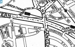
EPW041911 ENGLAND (1933). The Horse Ring football ground and various factories, Park Royal, from the south-west, 1933
© Copyright OpenStreetMap contributors and licensed by the OpenStreetMap Foundation. 2025. Cartography is licensed as CC BY-SA.
Nearby Images (7)
Details
| Title | [EPW041911] The Horse Ring football ground and various factories, Park Royal, from the south-west, 1933 |
| Reference | EPW041911 |
| Date | June-1933 |
| Link | |
| Place name | PARK ROYAL |
| Parish | |
| District | |
| Country | ENGLAND |
| Easting / Northing | 518898, 182674 |
| Longitude / Latitude | -0.28574057674487, 51.529960366221 |
| National Grid Reference | TQ189827 |


![[EPW041911] The Horse Ring football ground and various factories, Park Royal, from the south-west, 1933](http://britainfromabove.org.uk/sites/all/libraries/aerofilms-images/public/100x100/EPW/041/EPW041911.jpg)
![[EPW041914] The Horse Ring football ground and various factories, Park Royal, from the south-west, 1933](http://britainfromabove.org.uk/sites/all/libraries/aerofilms-images/public/100x100/EPW/041/EPW041914.jpg)
![[EPW041912] The Horse Ring football ground and various factories, Park Royal, from the south-west, 1933](http://britainfromabove.org.uk/sites/all/libraries/aerofilms-images/public/100x100/EPW/041/EPW041912.jpg)
![[EPW041913] The Horse Ring football ground and various factories, Park Royal, from the south-west, 1933](http://britainfromabove.org.uk/sites/all/libraries/aerofilms-images/public/100x100/EPW/041/EPW041913.jpg)
![[EPW041910] The Horse Ring football ground and various factories, Park Royal, from the south-west, 1933](http://britainfromabove.org.uk/sites/all/libraries/aerofilms-images/public/100x100/EPW/041/EPW041910.jpg)
![[EPW041848] The Horse Ring football ground, Park Royal, from the south-west, 1933. This image has been produced from a damaged negative.](http://britainfromabove.org.uk/sites/all/libraries/aerofilms-images/public/100x100/EPW/041/EPW041848.jpg)
![[EAW031550] The Guinness Brewery and environs, Park Royal, 1950. This image has been produced from a print marked by Aerofilms Ltd for photo editing.](http://britainfromabove.org.uk/sites/all/libraries/aerofilms-images/public/100x100/EAW/031/EAW031550.jpg)


