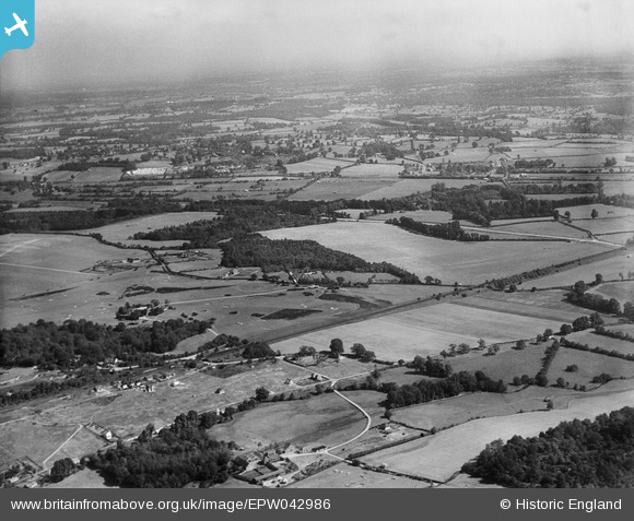
EPW042986 ENGLAND (1933). Denham Golf Course, Denham Green, from the south-west, 1933
© Copyright OpenStreetMap contributors and licensed by the OpenStreetMap Foundation. 2025. Cartography is licensed as CC BY-SA.
Details
| Title | [EPW042986] Denham Golf Course, Denham Green, from the south-west, 1933 |
| Reference | EPW042986 |
| Date | September-1933 |
| Link | |
| Place name | DENHAM GREEN |
| Parish | DENHAM |
| District | |
| Country | ENGLAND |
| Easting / Northing | 503040, 187807 |
| Longitude / Latitude | -0.51278612651377, 51.579220357637 |
| National Grid Reference | TQ030878 |
Pins
 moses72 |
Thursday 27th of June 2013 12:52:43 PM | |
 moses72 |
Thursday 27th of June 2013 12:50:53 PM | |
This was the site of No.1 Officer Cadet Battalion Royal Flying Corps during WW1. |
 The Laird |
Thursday 3rd of July 2014 05:15:32 PM |
 moses72 |
Thursday 27th of June 2013 12:44:15 PM | |
 moses72 |
Thursday 27th of June 2013 12:40:12 PM | |
 moses72 |
Thursday 27th of June 2013 12:39:36 PM | |
 moses72 |
Thursday 27th of June 2013 12:38:07 PM | |
 moses72 |
Thursday 27th of June 2013 12:36:57 PM | |
 moses72 |
Thursday 27th of June 2013 12:34:47 PM | |
 moses72 |
Thursday 27th of June 2013 12:33:53 PM | |
 moses72 |
Thursday 27th of June 2013 12:32:38 PM | |
 moses72 |
Thursday 27th of June 2013 12:31:42 PM |
User Comment Contributions
 The Laird |
Tuesday 24th of June 2014 11:04:14 PM |


