
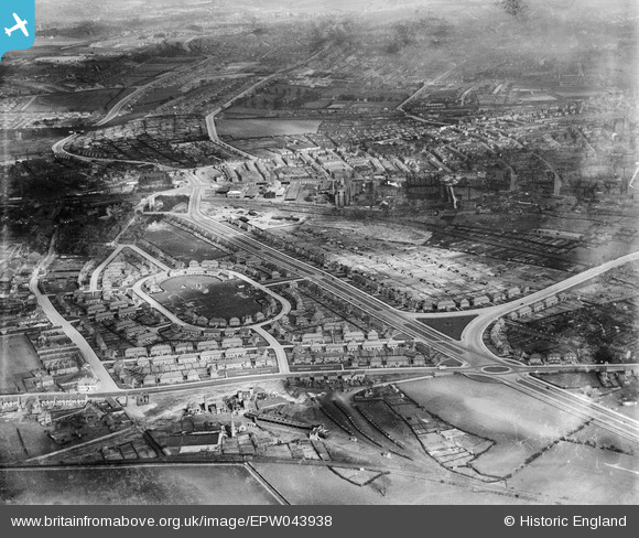
EPW043938 ENGLAND (1934). The Newcastle Colliery and housing at Bracknell Crescent and the Western Boulevard, Whitemoor, from the south-west, 1934
© Copyright OpenStreetMap contributors and licensed by the OpenStreetMap Foundation. 2025. Cartography is licensed as CC BY-SA.
Nearby Images (7)
EPW043938

EPW043608

EPW043611

EPW038029

EPW038037

EPW043940

EPW043939

Details
| Title | [EPW043938] The Newcastle Colliery and housing at Bracknell Crescent and the Western Boulevard, Whitemoor, from the south-west, 1934 |
| Reference | EPW043938 |
| Date | April-1934 |
| Link | |
| Place name | WHITEMOOR |
| Parish | |
| District | |
| Country | ENGLAND |
| Easting / Northing | 454738, 342188 |
| Longitude / Latitude | -1.1847633504305, 52.973935070308 |
| National Grid Reference | SK547422 |
Pins
Be the first to add a comment to this image!