
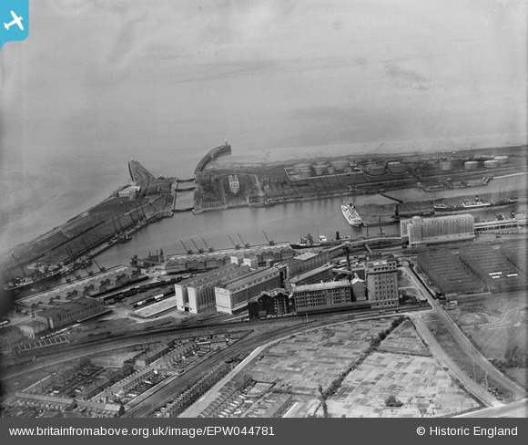
EPW044781 ENGLAND (1934). The Royal Edward Dock, Avonmouth, from the south-east, 1934
© Copyright OpenStreetMap contributors and licensed by the OpenStreetMap Foundation. 2025. Cartography is licensed as CC BY-SA.
Nearby Images (13)
EPW044781

EPW044779

EPW044775

EPW019268

EPW044776

EPW014697

EPW044780

EPW008648

EPW044778

EPW019267

EPW019269

EPW005537

EPW044777

Details
| Title | [EPW044781] The Royal Edward Dock, Avonmouth, from the south-east, 1934 |
| Reference | EPW044781 |
| Date | June-1934 |
| Link | |
| Place name | AVONMOUTH |
| Parish | |
| District | |
| Country | ENGLAND |
| Easting / Northing | 351426, 178511 |
| Longitude / Latitude | -2.6999015149036, 51.502961128223 |
| National Grid Reference | ST514785 |
Pins
 steve |
Friday 14th of August 2015 10:34:59 PM | |
steve |
Friday 14th of August 2015 10:22:57 PM | |
steve |
Friday 14th of August 2015 10:15:06 PM | |
 Class31 |
Saturday 22nd of February 2014 08:03:22 PM |