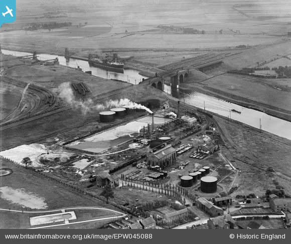
EPW045088 ENGLAND (1934). British Tar Products Ltd and the Manchester Ship Canal, Cadishead, 1934
© Copyright OpenStreetMap contributors and licensed by the OpenStreetMap Foundation. 2025. Cartography is licensed as CC BY-SA.
Nearby Images (6)
Details
| Title | [EPW045088] British Tar Products Ltd and the Manchester Ship Canal, Cadishead, 1934 |
| Reference | EPW045088 |
| Date | July-1934 |
| Link | |
| Place name | CADISHEAD |
| Parish | |
| District | |
| Country | ENGLAND |
| Easting / Northing | 371462, 392083 |
| Longitude / Latitude | -2.4295065080347, 53.424509724036 |
| National Grid Reference | SJ715921 |


![[EPW045088] British Tar Products Ltd and the Manchester Ship Canal, Cadishead, 1934](http://britainfromabove.org.uk/sites/all/libraries/aerofilms-images/public/100x100/EPW/045/EPW045088.jpg)
![[EPW045091] British Tar Products Ltd and the Manchester Ship Canal, Cadishead, 1934](http://britainfromabove.org.uk/sites/all/libraries/aerofilms-images/public/100x100/EPW/045/EPW045091.jpg)
![[EPW045086] British Tar Products Ltd and the Manchester Ship Canal, Cadishead, 1934](http://britainfromabove.org.uk/sites/all/libraries/aerofilms-images/public/100x100/EPW/045/EPW045086.jpg)
![[EPW045089] British Tar Products Ltd and the Manchester Ship Canal, Cadishead, from the east, 1934](http://britainfromabove.org.uk/sites/all/libraries/aerofilms-images/public/100x100/EPW/045/EPW045089.jpg)
![[EPW045090] British Tar Products Ltd and the Manchester Ship Canal, Cadishead, from the east, 1934](http://britainfromabove.org.uk/sites/all/libraries/aerofilms-images/public/100x100/EPW/045/EPW045090.jpg)
![[EPW045087] British Tar Products Ltd and the Manchester Ship Canal, Cadishead, 1934](http://britainfromabove.org.uk/sites/all/libraries/aerofilms-images/public/100x100/EPW/045/EPW045087.jpg)

