
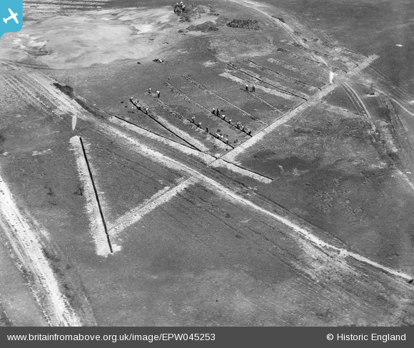
EPW045253 ENGLAND (1934). Land Drainage on Sunningdale Golf Course, Brick Hill, 1934
© Copyright OpenStreetMap contributors and licensed by the OpenStreetMap Foundation. 2025. Cartography is licensed as CC BY-SA.
Nearby Images (3)
EPW045253

EPW045260

EPW045258

Details
| Title | [EPW045253] Land Drainage on Sunningdale Golf Course, Brick Hill, 1934 |
| Reference | EPW045253 |
| Date | July-1934 |
| Link | |
| Place name | FOX HILL |
| Parish | CHOBHAM |
| District | |
| Country | ENGLAND |
| Easting / Northing | 495853, 164913 |
| Longitude / Latitude | -0.62269883430515, 51.37467327824 |
| National Grid Reference | SU959649 |
Pins
Be the first to add a comment to this image!