
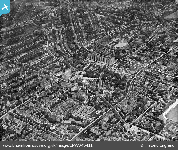
EPW045411 ENGLAND (1934). Abbey Road and environs, St John's Wood, from the south-west, 1934
© Copyright OpenStreetMap contributors and licensed by the OpenStreetMap Foundation. 2025. Cartography is licensed as CC BY-SA.
Nearby Images (18)
EPW045411

EAW018356

EAW025336

EAW025333

EAW025338

EAW025334

EAW025335

EAW025339

EAW025337

EAW021740

EPW020916

EPW020697

EPW020914

EPW020698

EPW020917

EPW020911

EPW020912

EPW020913

Details
| Title | [EPW045411] Abbey Road and environs, St John's Wood, from the south-west, 1934 |
| Reference | EPW045411 |
| Date | July-1934 |
| Link | |
| Place name | ST JOHN'S WOOD |
| Parish | |
| District | |
| Country | ENGLAND |
| Easting / Northing | 526460, 182941 |
| Longitude / Latitude | -0.17667414699864, 51.530716865836 |
| National Grid Reference | TQ265829 |
Pins
 Bob |
Wednesday 5th of March 2025 04:52:04 PM | |
RichardWW |
Wednesday 23rd of October 2024 04:02:17 AM | |
rawanhussin |
Monday 7th of October 2024 06:10:51 PM | |
Kathy Emery |
Monday 29th of April 2024 04:42:06 PM | |
Kathy Emery |
Monday 29th of April 2024 04:40:33 PM | |
Kathy Emery |
Monday 29th of June 2020 02:17:33 PM | |
Kathy Emery |
Saturday 17th of August 2019 08:06:52 PM | |
Kathy Emery |
Saturday 17th of August 2019 08:05:26 PM | |
Danidee73 |
Saturday 27th of October 2018 06:45:53 PM | |
Danidee73 |
Saturday 27th of October 2018 06:37:27 PM | |
H.J.Hill |
Tuesday 8th of March 2016 02:52:07 PM | |
Symonds & Sampson |
Thursday 31st of October 2013 05:17:30 PM |