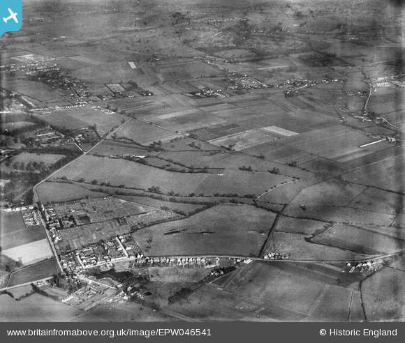
EPW046541 ENGLAND (1935). The site of The Queen Mother Reservoir, Datchet, 1935
© Copyright OpenStreetMap contributors and licensed by the OpenStreetMap Foundation. 2025. Cartography is licensed as CC BY-SA.
Details
| Title | [EPW046541] The site of The Queen Mother Reservoir, Datchet, 1935 |
| Reference | EPW046541 |
| Date | February-1935 |
| Link | |
| Place name | DATCHET |
| Parish | DATCHET |
| District | |
| Country | ENGLAND |
| Easting / Northing | 500470, 177066 |
| Longitude / Latitude | -0.55293212460361, 51.483127330029 |
| National Grid Reference | TQ005771 |
Pins
 Mike Holder |
Saturday 3rd of February 2018 06:03:09 PM | |
 Mike Holder |
Saturday 3rd of February 2018 05:45:24 PM | |
 Tony S |
Tuesday 29th of September 2015 10:20:28 PM | |
 Tony S |
Tuesday 29th of September 2015 10:17:04 PM | |
 Class31 |
Wednesday 17th of July 2013 09:15:07 AM | |
 Mike Holder |
Tuesday 21st of May 2013 09:45:27 AM | |
 Mike Holder |
Tuesday 21st of May 2013 09:44:08 AM | |
 Mike Holder |
Tuesday 21st of May 2013 09:42:07 AM | |
 Mike Holder |
Tuesday 21st of May 2013 09:28:58 AM | |
 Mike Holder |
Tuesday 21st of May 2013 09:27:24 AM | |
 Mike Holder |
Tuesday 21st of May 2013 09:20:12 AM | |
 Mike Holder |
Tuesday 21st of May 2013 09:11:58 AM |


![[EPW046541] The site of The Queen Mother Reservoir, Datchet, 1935](http://britainfromabove.org.uk/sites/all/libraries/aerofilms-images/public/100x100/EPW/046/EPW046541.jpg)
![[EPW046537] The site of The Queen Mother Reservoir, Datchet, 1935](http://britainfromabove.org.uk/sites/all/libraries/aerofilms-images/public/100x100/EPW/046/EPW046537.jpg)