
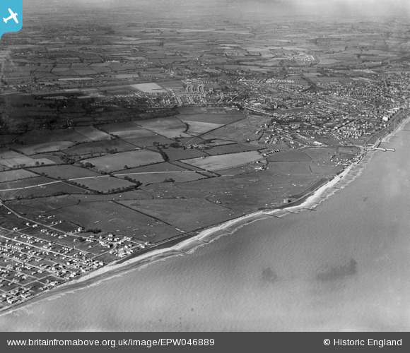
EPW046889 ENGLAND (1935). The Clacton-on-Sea Golf Course alongside the seafront and the town, Clacton-on-Sea, 1935
© Copyright OpenStreetMap contributors and licensed by the OpenStreetMap Foundation. 2025. Cartography is licensed as CC BY-SA.
Nearby Images (5)
EPW046889

EPW046884

EPW046887

EPW046886

EPW046883

Details
| Title | [EPW046889] The Clacton-on-Sea Golf Course alongside the seafront and the town, Clacton-on-Sea, 1935 |
| Reference | EPW046889 |
| Date | April-1935 |
| Link | |
| Place name | CLACTON-ON-SEA |
| Parish | |
| District | |
| Country | ENGLAND |
| Easting / Northing | 616097, 213893 |
| Longitude / Latitude | 1.1332174032226, 51.781452263346 |
| National Grid Reference | TM161139 |
Pins
 Amiguru |
Tuesday 4th of March 2014 10:05:15 PM |