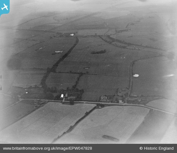
EPW047828 ENGLAND (1935). Open countryside proposed for the site of Warrington Aerodrome, Croft, 1935
© Copyright OpenStreetMap contributors and licensed by the OpenStreetMap Foundation. 2024. Cartography is licensed as CC BY-SA.
Nearby Images (8)
Details
| Title | [EPW047828] Open countryside proposed for the site of Warrington Aerodrome, Croft, 1935 |
| Reference | EPW047828 |
| Date | June-1935 |
| Link | |
| Place name | CROFT |
| Parish | CROFT |
| District | |
| Country | ENGLAND |
| Easting / Northing | 365539, 394212 |
| Longitude / Latitude | -2.5188790459102, 53.443293917526 |
| National Grid Reference | SJ655942 |
Pins
 Paul |
Monday 3rd of November 2014 05:54:57 PM | |
 Paul |
Monday 3rd of November 2014 05:47:33 PM | |
 Paul |
Monday 3rd of November 2014 05:46:30 PM | |
 Paul |
Monday 3rd of November 2014 05:45:08 PM | |
 Paul |
Monday 3rd of November 2014 05:43:37 PM | |
 Paul |
Monday 3rd of November 2014 05:41:25 PM | |
 Paul |
Monday 3rd of November 2014 05:41:00 PM |


![[EPW047828] Open countryside proposed for the site of Warrington Aerodrome, Croft, 1935](http://britainfromabove.org.uk/sites/all/libraries/aerofilms-images/public/100x100/EPW/047/EPW047828.jpg)
![[EPW047830] Open countryside proposed for the site of Warrington Aerodrome, Croft, from the north-east, 1935](http://britainfromabove.org.uk/sites/all/libraries/aerofilms-images/public/100x100/EPW/047/EPW047830.jpg)
![[EPW047833] Open countryside proposed for the site of Warrington Aerodrome, Croft, from the north-west, 1935](http://britainfromabove.org.uk/sites/all/libraries/aerofilms-images/public/100x100/EPW/047/EPW047833.jpg)
![[EPW047827] Open countryside proposed for the site of Warrington Aerodrome, Croft, 1935](http://britainfromabove.org.uk/sites/all/libraries/aerofilms-images/public/100x100/EPW/047/EPW047827.jpg)
![[EPW047829] Open countryside proposed for the site of Warrington Aerodrome, Croft, from the north-east, 1935](http://britainfromabove.org.uk/sites/all/libraries/aerofilms-images/public/100x100/EPW/047/EPW047829.jpg)
![[EPW047832] Open countryside proposed for the site of Warrington Aerodrome, Croft, 1935](http://britainfromabove.org.uk/sites/all/libraries/aerofilms-images/public/100x100/EPW/047/EPW047832.jpg)
![[EPW047817] Open countryside proposed for the site of Warrington Aerodrome, Croft, from the north-east, 1935](http://britainfromabove.org.uk/sites/all/libraries/aerofilms-images/public/100x100/EPW/047/EPW047817.jpg)
![[EPW047831] Open countryside proposed for the site of Warrington Aerodrome, Croft, 1935](http://britainfromabove.org.uk/sites/all/libraries/aerofilms-images/public/100x100/EPW/047/EPW047831.jpg)