
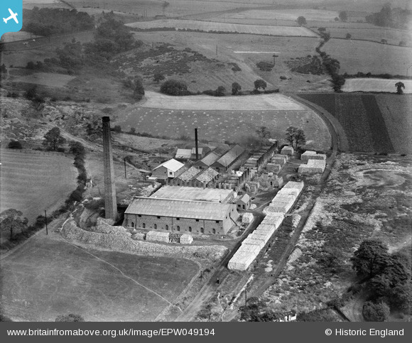
EPW049194 ENGLAND (1935). Durham Brick and Tile Co Ltd Claypath Works, Durham, 1935
© Copyright OpenStreetMap contributors and licensed by the OpenStreetMap Foundation. 2025. Cartography is licensed as CC BY-SA.
Nearby Images (7)
EPW049194

EPW049198

EPW049197

EPW049199

EPW049196

EPW049200

EPW049195

Details
| Title | [EPW049194] Durham Brick and Tile Co Ltd Claypath Works, Durham, 1935 |
| Reference | EPW049194 |
| Date | September-1935 |
| Link | |
| Place name | DURHAM |
| Parish | |
| District | |
| Country | ENGLAND |
| Easting / Northing | 427663, 543348 |
| Longitude / Latitude | -1.5698158761044, 54.78417296174 |
| National Grid Reference | NZ277433 |
Pins
 itchard |
Friday 20th of January 2017 10:58:27 AM | |
 Dylan Moore |
Saturday 22nd of June 2013 12:37:18 PM |