
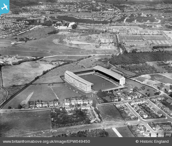
EPW049450 ENGLAND (1935). Twickenham Rugby Football Ground and environs, Twickenham, from the south, 1935
© Copyright OpenStreetMap contributors and licensed by the OpenStreetMap Foundation. 2025. Cartography is licensed as CC BY-SA.
Nearby Images (22)
EPW049450

EPW049448

EPW025844

EPW017385

EPW049451

EPW023249

EPW025845

EPW025842

EPR000638

EPW049453

EPW025839

EPW049449

EPW025843

EPW049454

EPW025840

EPW034843

EPW022945

EPW049447

EPW025841

EPW049455

EPW049446

EPW049452

Details
| Title | [EPW049450] Twickenham Rugby Football Ground and environs, Twickenham, from the south, 1935 |
| Reference | EPW049450 |
| Date | October-1935 |
| Link | |
| Place name | TWICKENHAM |
| Parish | |
| District | |
| Country | ENGLAND |
| Easting / Northing | 515328, 174230 |
| Longitude / Latitude | -0.3399486207803, 51.454800122246 |
| National Grid Reference | TQ153742 |
Pins
 Martin Devlin |
Friday 9th of February 2024 10:53:34 PM | |
Martin Devlin |
Monday 31st of January 2022 05:34:02 PM | |
Martin Devlin |
Monday 31st of January 2022 05:33:12 PM | |
Martin Devlin |
Monday 31st of January 2022 05:31:22 PM | |
Martin Devlin |
Monday 31st of January 2022 05:29:08 PM | |
Martin Devlin |
Monday 31st of January 2022 05:27:37 PM |