
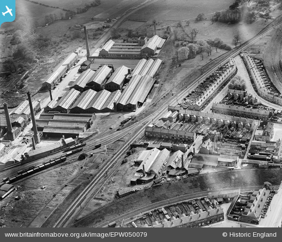
EPW050079 ENGLAND (1936). The Birmingham Factory Centre and housing off Cotteridge Road, King's Norton, 1936
© Copyright OpenStreetMap contributors and licensed by the OpenStreetMap Foundation. 2025. Cartography is licensed as CC BY-SA.
Nearby Images (5)
EPW050079

EPW050078

EPW050080

EPW018377
, King's Norton, 1927. This image has been produced from a copy-negative.")
EPW018368
, Cotteridge Road and environs, Cotteridge, from the north-west, 1927. This image has been produced from a copy-negative.")
Details
| Title | [EPW050079] The Birmingham Factory Centre and housing off Cotteridge Road, King's Norton, 1936 |
| Reference | EPW050079 |
| Date | May-1936 |
| Link | |
| Place name | KING'S NORTON |
| Parish | |
| District | |
| Country | ENGLAND |
| Easting / Northing | 405219, 279789 |
| Longitude / Latitude | -1.9232571021728, 52.415695946079 |
| National Grid Reference | SP052798 |
Pins
 Ilwertornram4 |
Monday 10th of February 2025 09:28:42 AM | |
Ilwertornram4 |
Monday 10th of February 2025 09:07:39 AM | |
fossil |
Tuesday 17th of July 2018 09:28:03 PM | |
PURCELL |
Sunday 17th of November 2013 09:46:35 AM | |
PURCELL |
Sunday 17th of November 2013 09:46:05 AM | |
PURCELL |
Saturday 16th of November 2013 09:03:55 PM | |
PURCELL |
Saturday 16th of November 2013 09:03:15 PM | |
PURCELL |
Saturday 16th of November 2013 09:02:32 PM |