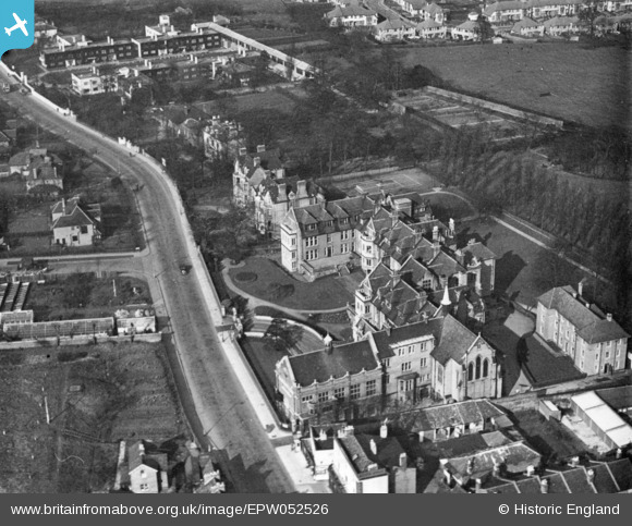
EPW052526 ENGLAND (1937). Crown Lane and the British Home and Hospital for Incurables, West Norwood, 1937. This image has been produced from a print.
© Copyright OpenStreetMap contributors and licensed by the OpenStreetMap Foundation. 2025. Cartography is licensed as CC BY-SA.
Details
| Title | [EPW052526] Crown Lane and the British Home and Hospital for Incurables, West Norwood, 1937. This image has been produced from a print. |
| Reference | EPW052526 |
| Date | 2-March-1937 |
| Link | |
| Place name | WEST NORWOOD |
| Parish | |
| District | |
| Country | ENGLAND |
| Easting / Northing | 531649, 171059 |
| Longitude / Latitude | -0.10633009458507, 51.422739780663 |
| National Grid Reference | TQ316711 |


![[EPW052526] Crown Lane and the British Home and Hospital for Incurables, West Norwood, 1937. This image has been produced from a print.](http://britainfromabove.org.uk/sites/all/libraries/aerofilms-images/public/100x100/EPW/052/EPW052526.jpg)
![[EPW052525] The British Home and Hospital for Incurables, West Norwood, 1937. This image has been produced from a print.](http://britainfromabove.org.uk/sites/all/libraries/aerofilms-images/public/100x100/EPW/052/EPW052525.jpg)
