
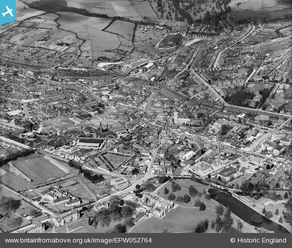
EPW052764 ENGLAND (1937). The town, High Wycombe, from the south, 1937
© Copyright OpenStreetMap contributors and licensed by the OpenStreetMap Foundation. 2025. Cartography is licensed as CC BY-SA.
Nearby Images (8)
EPW052764

EPW017821

EPW034492

EPW034496

EPW052765

EPW017826

EPW034491

EPW038415

Details
| Title | [EPW052764] The town, High Wycombe, from the south, 1937 |
| Reference | EPW052764 |
| Date | 24-March-1937 |
| Link | |
| Place name | HIGH WYCOMBE |
| Parish | |
| District | |
| Country | ENGLAND |
| Easting / Northing | 486510, 192786 |
| Longitude / Latitude | -0.75007417809872, 51.626762863974 |
| National Grid Reference | SU865928 |
Pins
 John Saunders |
Thursday 13th of February 2014 11:59:10 AM | |
John Saunders |
Thursday 13th of February 2014 11:57:57 AM | |
John Saunders |
Thursday 13th of February 2014 11:55:37 AM | |
John Saunders |
Thursday 13th of February 2014 11:50:50 AM | |
John Saunders |
Thursday 13th of February 2014 11:46:25 AM | |
John Saunders |
Thursday 13th of February 2014 11:45:49 AM | |
John Saunders |
Thursday 13th of February 2014 11:44:51 AM | |
John Saunders |
Thursday 13th of February 2014 11:42:11 AM | |
Apart from floodlights and proper terracing it didn't look any different the day it closed. |
gBr |
Tuesday 6th of January 2015 10:23:55 PM |