
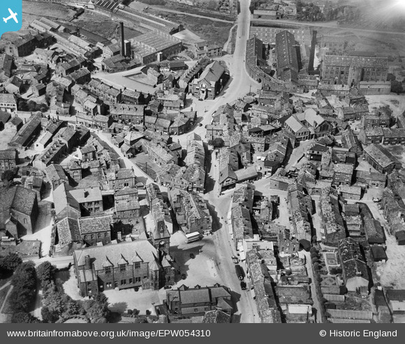
EPW054310 ENGLAND (1937). The town centre, Yeadon, 1937
© Copyright OpenStreetMap contributors and licensed by the OpenStreetMap Foundation. 2025. Cartography is licensed as CC BY-SA.
Nearby Images (18)
EPW054310

EPW054309

EPW054307

EAW008876

EAW008871

EAW008872

EAW008870

EAW008874

EAW036902

EAW036898

EAW036896

EAW036897

EAW036899

EAW008873

EAW008875

EAW008869

EAW036900

EAW036901

Details
| Title | [EPW054310] The town centre, Yeadon, 1937 |
| Reference | EPW054310 |
| Date | 14-July-1937 |
| Link | |
| Place name | YEADON |
| Parish | |
| District | |
| Country | ENGLAND |
| Easting / Northing | 420764, 441126 |
| Longitude / Latitude | -1.6842162611272, 53.865725938671 |
| National Grid Reference | SE208411 |
Pins
 Brick Collector |
Tuesday 9th of September 2014 07:46:33 PM |